Los Cusingos Bird Sanctuary in Alexander Skutch Biological Corridor

Los Cusingos Bird Sanctuary in Alexander Skutch Biological Corridor

Our search for “extraordinary” bird-watching places during a trip to Southern Costa Rica was handsomely rewarded. Following a birding “expedition” to Los Cusingos Bird Sanctuary, here it is what we’ve learned about it and the surrounding Alexander Skutch Biological Corridor.

What is a Biological Corridor?

First, a few words about the concept of Biological Corridors. It represents one of the most important conservation strategies currently promoted by the National System of Conservation Areas (SINAC) in Costa Rica. The purpose of a biological corridor is to provide connectivity “between protected wild areas, as well as between landscapes, ecosystems and habitats, natural or modified being rural or urban to ensure the maintenance of biodiversity and ecological processes and evolutionary; providing spaces of social agreement to promote investment in the conservation and sustainable use of biodiversity in those spaces.”

Costa Rica has a total of 47 biological corridors, which collectively cover over 30% of the country’s territory. The Alexander Skutch Biological Corridor (ASBC) is represented as #22 on the map of all Costa Rica’s biological corridors (SINAC).
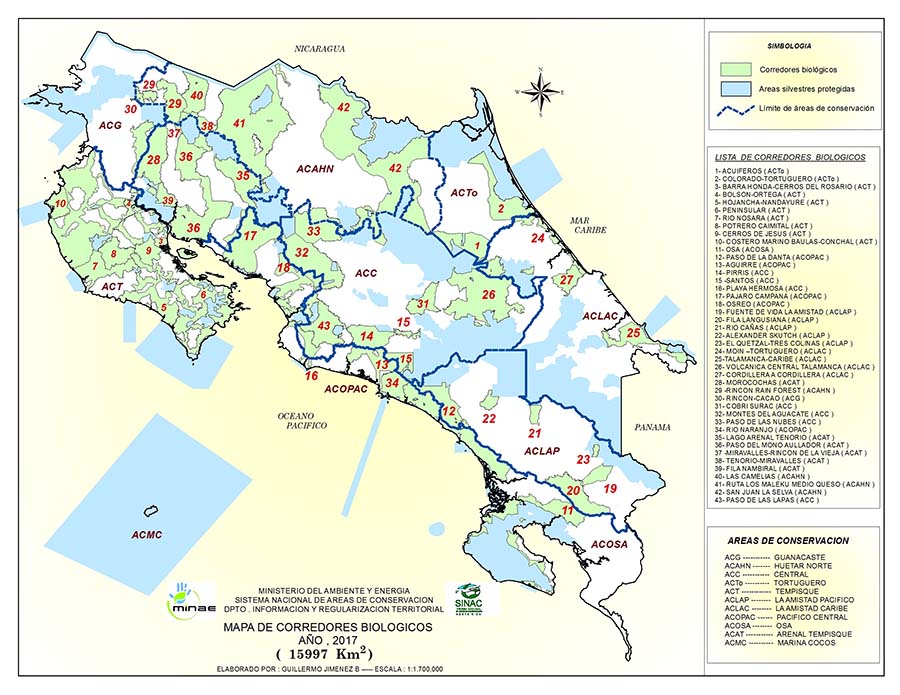
Map of Costa Rica Biological Corridors by SINAC

Biological Corridors of Costa Rica (SINAC)

Bird-Haven of Alexander Skutch Biological Corridor

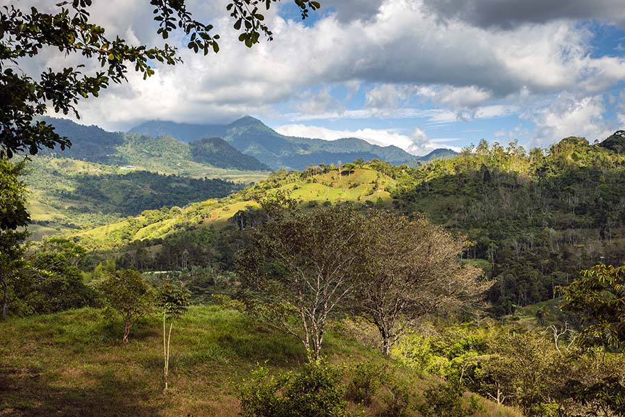
Alexander Skutch Biological Corridor is situated in the El General Valley, between the Talamanca Mountain Range and the Coastal Mountain Range (Fila Costena). ACBS was created in 2004 to protect the area within the Rio Peñas Blancas watershed. This type of habitat is called Tropical Premontane Wet Life Zone. The area is a home for a variety of residential bird species and a “safe haven” for altitudinal and long-range migrants. According to the census conducted by the Tropical Scientific Center (which now operates Los Cusingos Bird Sanctuary), over 300 avian species have been recorded over the years, 200 of which has been described by Alexander Skutch himself.

Stretching between the lowlands of Los Cusingos Bird Sanctuary (elevation 650-750 m) in the south and the mid-elevation premontane forest (1200-1500 m) of the Las Nubes Nature Reserve in the north, Alexander Skutch Biological Corridor offers birdwatchers an opportunity to observe residential and migratory birds within different altitudes bands.

The corridor’s northern boundary is also a gateway to the highlands of Mount Chirripó. This area within the Chirripó National Park has its own unique habitat and population of birds, including endemic species, such as Volcano Hummingbird (Selasphorus flammula).
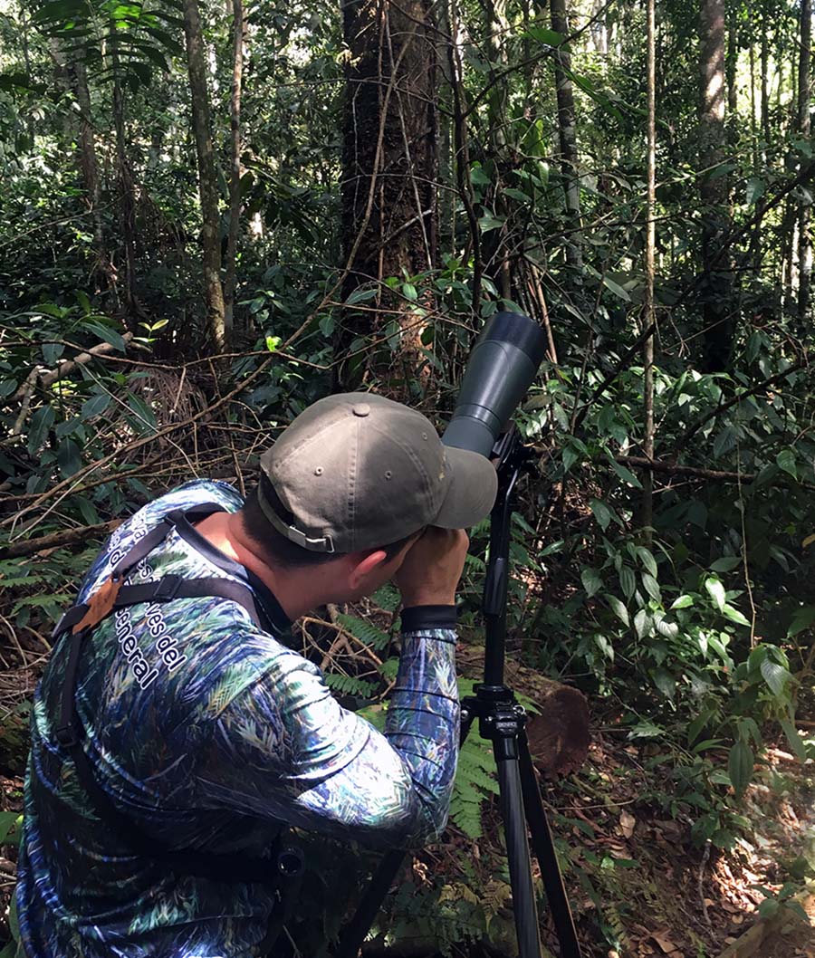
Birdwatching in Los Cusingos in Costa Rica

Birdwatching in Los Cusingos

Plants of Los Cusingos

The forest is the cathedral in which I worship”

A.F. Skutch. “A question”, May 17, 1942

Los Cusingos is one of the last remaining forested lowland areas in El General Valley. In addition to animals, the refuge is home to a wide variety of plants. 298 native species of trees, shrubs and vines have been reported by a recent survey of the refuge (referenced below).

The most diverse group is Melastomataceae family (35 different species were reported), which is rather typical for mid-elevation areas of Costa Rica. The dark-blue fruits of melastomes serve as a popular food source for birds in the sanctuary, especially among manakins and tanagers. Birds ‘return the favor” by doing a great job as seed dispersers for this ubiquitous group of plants (Stiles & Rosselli, 1993).

Several fern species, including endemic and threatened species, such as Cyathea bicrenate and Cyathea multiflora, can be spotted near the garden and along the trails. A dozen palm species have also been described in Los Cusingos, including a walking palm (Socratea exorrhiza or chonta) with distinctive widely spaced roots covered with spines.
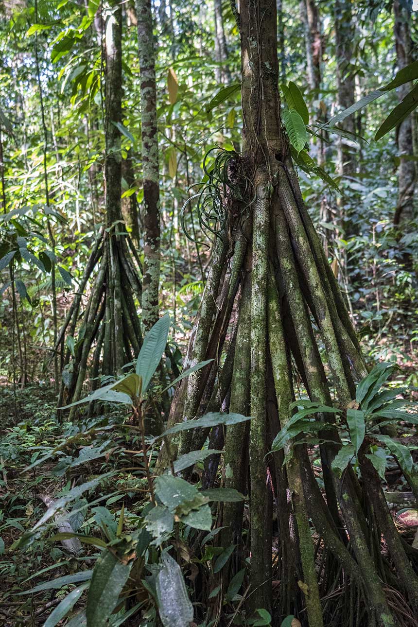
Roots of Walking Palm Socratea exorhizza

Walking Palms

Rare plants, such as vulnerable Tocoyena pittieri and endangered Weberocereus imitans, Costa Rican endemics Tabernaemontana pauli and a native bamboo species Chusquea simpliciflora have also been recorded.

A survey of the woody and climbing plants of the Refugio de Aves Dr. Alexander Skutch, “Los Cusingos”, Perez Zeledon Canton, Costa Rica contains a full list of 314 species of trees, shrubs and vines of Los Cusingos (217 genera and 84 families).

Brief History of Los Cusingos, Alexander Skutch’s Home

Around the time Alexander Skutch Biological Corridor was created, a questionnaire survey of visitors to Los Cusingos was conducted. Surprisingly, most travelers to the area were not familiar with Dr. Alexander Skutch’s life and contribution to the field of neotropical ornithology.

I sure hope it’s been changing. The man had a fascinating scientific career (including his dramatic professional makeover) and an inspirational life philosophy. It does not take a trivial amount of courage to quit a successful post-doctorate job as a botanist (during the Great Depression!) to make a transition into a brand-new field of ornithology. This remarkable “foliage to plumage” makeover eventually resulted in publication of 20 scientific books and over 200 articles about tropical birds (in addition to dozens philosophy books and papers).

Gary Stiles (who together with Dr. Skutch co-authored one of the most popular books on tropical birds “Guide to the Birds of Costa Rica”) rightfully stated:

The legacy of Alexander Skutch to Neotropical ornithology is, quite simply, the largest body of natural-history information ever collected by a single observer.”

Here is an extensive bibliography of Alexander Skutch. This collection of books and articles (many of which are in a pdf format) is a great resource for any birding enthusiast or anyone interested in Alexander Skutch’s legacy in science and philosophy. You can also learn more about Alexander Skutch’s career transition and his first years living in Los Cusingos from his notes, which were edited and compiled by Peter Scheers: Early Views of Alexander F. Skutch: Selection from his nature diaries, philosophical notebooks (1929-1941).

Writing Desk and Typewriter of Alexander Skutch

Writing Desk and Typewriter of Alexander Skutch

Interestingly, a genus of birds bore Dr. Skutch’s name (Skutchia), in recognition of his contribution to the field of ornithology. Unfortunately, the monotypic Skutchia genus (with a single ant-eater species Pale-faced Antbird (Skutchia borbae)) was recently merged into Phlegopsis (Thamnophilidae), based on genetic evidence.

During his post-doctoral studies in Panama, Skutch became increasingly interested in neotropical birds. This powerful calling turned later into a lifelong passion and second scientific career. Spending all his time “in the field”, Alexander Skutch has described and published feeding, nesting, parenting behaviors and sociobiology of over two hundreds of neotropical bird species.

However, before Skutch made a name for himself in ornithology, the botanical projects were “paying his bills”. For almost a decade, Skutch was embarking on various expeditions to collect plants for botanical gardens, universities and natural history museums around the world. National Herbarium in Washington, the Arnold Arboretum of Harvard University, Kew Gardens, the Naturhistoriska Riksmuseet, the Missouri Botanical Gardens, Field Museum in Chicago, the New York Botanical Gardens, were all among Dr. Skutch’s customers buying his herbarium specimens.

After a decade of saving money and searching for a perfect place to call his own, Skutch’s dream finally came true. In 1941, he paid 5000 colons for 53 hectares of farmland and primary growth forest on the banks of Peñas Blanca River in the El General Valley. A year later, Skutch expanded the property to 77 hectares by buying a neighboring farm. This became “Los Cusingos”, Alexander Skutch’s home for over 60 years.
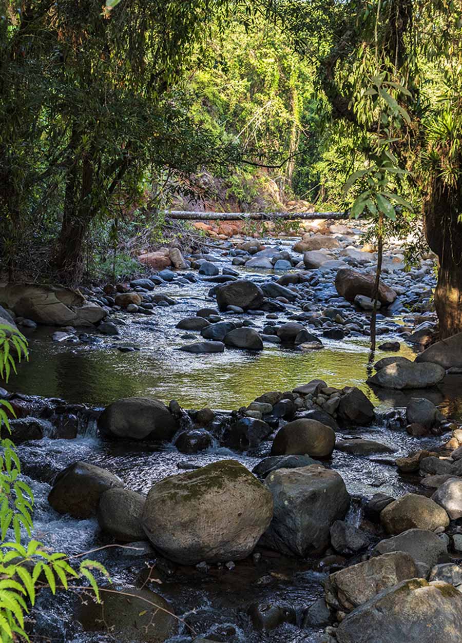
Rio Penas Blancas in Quizarra Perez Zeledon

El Río Peñas Blancas

“Los Cusingos” – What is in the Name?

Los Cusingos is the local name for the Fiery-billed Araçari (Pteroglossus frantzii), a smaller member of the toucan family, which is fairly common in the area. Although these birds (characterized by Dr. Skutch himself as “presumptuous bandits” for their distinctive behavior) were not among his “favorites”, Skutch named his farm by their vernacular name (los cusingos) to keep it simple and easy for the locals to pronounce. The birds of his choice, the Jacamar, did not have a common Costa Rican name at that time.

Early Days of Los Cusingos

With the purchase of “Los Cusingos”, Skutch became a homesteading naturalist, who truly appreciated a simple, almost ascetic, lifestyle. It allowed him to “use a small stock of energy for contemplation of the eternal truths”. Despite his academic background, Skutch did not shun manual labor. He built his own house and made wooden furniture (most of which visitors can still see in the House Museum at Los Cusingos).

I love the unspoiled aspects of nature, forests and rivers and mountains, and shall never long be happy separated from them. I would rather earn my daily bread by the humblest rural occupation than occupy the most envied professorship at a university in some great city

A.F. Skutch. Untitled, Journal, 1931

As a life-long vegetarian, he also grew his own food, including rice and beans, coffee and sugar cane. He, and later his family, remained living “off-the-grid” for almost 50 years, until mid-90s (when his wife, Pamela, at last, convinced him to get connected to electrical power and to buy their first refrigerator).
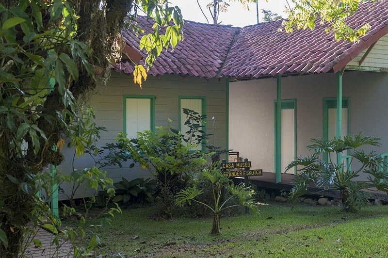
Alexander Skutch House Museum in Los Cusingos Bird Sanctuary

House of Alexander Skutch

In the early years, Skutch faced a great deal of adversity at Los Cusingos. He struggled through forest fires, sickness of his farm animals, and troubles with the neighbors, who did not “keep their pigs at home” or pay back their debts.

Early in the newfound career, Skutch also struggled to get his first tropical field ornithology books published anywhere. In 1944, he wrote:

”But in dedicating myself to the study of nature, I also committed myself to making my discoveries available to others. In this last I have lamentably failed; my books without exception remain unpublished”

“Study of the birds,” Thoughts, Vol. 2, June 8, 1944

Then came the recognition. In 1946-1947, he received a fellowship from Guggenheim Foundation, a renowned American scientific institution. Soon after, in recognition of his publications on Central American birds, he also became a Fellow of the American Ornithologists’ Union (AOU).

Despite enjoying the solitude of the tropical forest, Skutch did not seem to be fully content with his reclusive life of a bachelor. In 1950, he married Pamela Lankester (Lancaster), a daughter of an English naturalist and orchid enthusiast Charles Lankester (whose private gardens became one of the best botanical gardens and plant research centers of Costa Rica and is now named in his honor Jardin Botanico Lankester).

According to Skutch himself, Pamela’s arrival to Los Cusingos improved their “public relations with the neighbors”. Later, the couple adopted Edwin, a son of a local worker. Pamela and Alexander Skutch had lived happily at “Los Cosingos” until their last days, and were both buried on the grounds of the Bird Sanctuary, behind their house. Dr. Skutch passed away on May 12 (2004), just 8 days before his 100-years birthday. Pamela died 4 years prior.

Alexander Skutch Festival

Despite his uneasy early relations with the neighbors in Quizarra, Alexander Skutch’s legacy (and later his wife Pamela) had a profound effect on local community development. To celebrate his life and contribution, Alexander Skutch Festival was organized in 2013 by the York University Professor Felipe Montoya, as a part of the Las Nubes Project.

Ever since, the festival became a popular community tradition with mountain bike races around the Alexander Skutch Biological Corridor, horse races, soccer games, and much more. The festival is held every May on a weekend closest to Alexander Skutch’s birthday (May 20th). The proceeds from the sale of food and beverages during the festival go to the local school funding. For more information about the festival, check out the Las Nubes Project’s website.
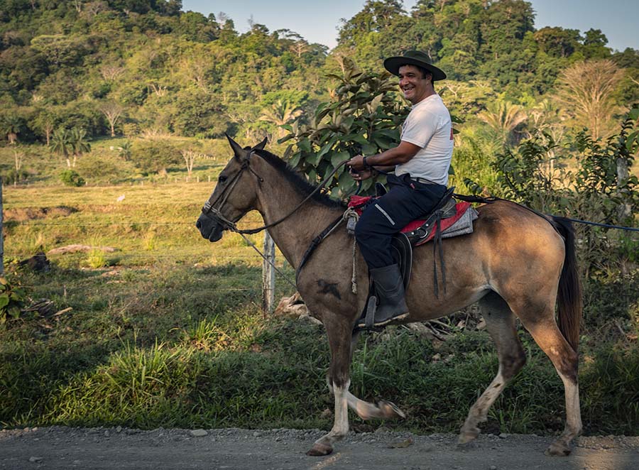
Horseback riding Costa Rica

Staying in Quizarra – Home of Los Cusingos Bird Sanctuary

Staying in Quizarra – Home of Los Cusingos Bird Sanctuary

Los Cusingos Bird Sanctuary, the enduring legacy of the prominent American “botanist-turned-ornithologist” Dr. Alexander Skutch, is located in a small town of Quizarra. Although less visited than other birding hotspots in Costa Rica, it is one of the primary destinations for naturalists visiting El General Valley. On our bird-watching tour to Los Cusingos, we have met some “hard core” birders, who kept coming to this historic former “farm” year after year. Its solitude and the richness of the local avifauna where the major draws. Sightings of over 300 bird species (more than half of which are residential), have been reported for Los Cusingos by the Tropical Science Center (TSC), which currently oversees the sanctuary.

Staying next-door to Los Cusingos

One can reach Los Cusingos from San Jose (takes about 4 hours each way) on a day trip, but this is hardly a good option for an early-morning birding walk. A better alternative is to stay overnight in San Isidro del General, which has a wider selection of lodging options for any budget. The distance between San Isidro del General and Los Cusingos is about 9 miles (via Rt.326), with travel time of 20-30 minutes. The road is paved, except a couple of miles on gravel surface just before the sanctuary entrance.

San Isidro del General is a most unattractive place – despite its attractive setting.

This is a direct quote from Alexander Skutch’s notes, which describes his first impression of San Isidro del General upon his arrival in 1935. One may or may not agree with this assessment, but this unflattering mention of the place prompted us look for lodging alternatives closer to Los Cusingos. Quite naturally, we turned to Quizarra, a small village where the sanctuary was located.

What does the Word “Quizarra” Mean?

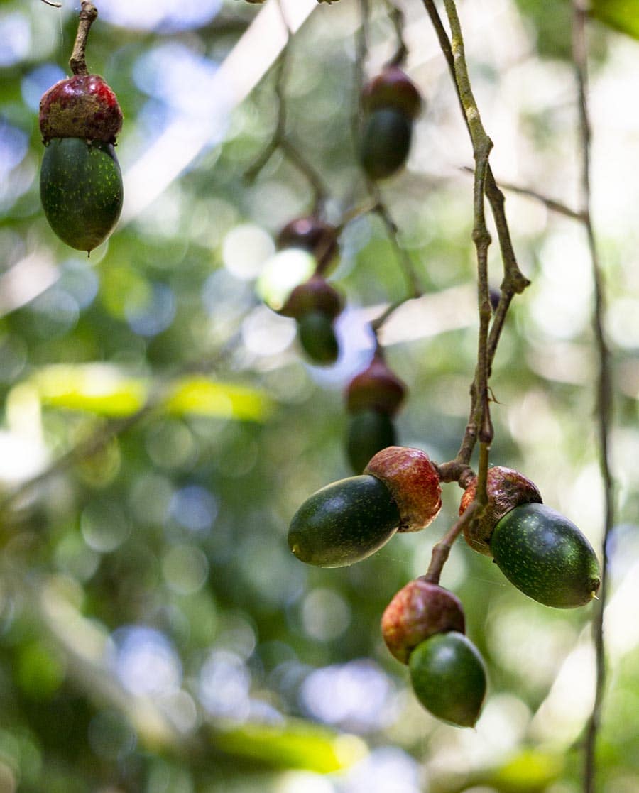
In case you’ve been wondering about the name: Quizarra is a common Costa Rican name for Ocotea, a tree which belongs to a larger family of plants, including the wild relatives of avocado. The fruits produced by these trees are an important food source for many local animals and birds, including the iconic Resplendent Quetzal. Unfortunately, Ocotea trees have also been traditionally used in Costa Rica as a source of commercial timbers.

Fruits of Quizarra (Ocotea) tree, a wild relative of avocado

Fruits of Quizarra (Ocotea) tree

Accommodations in Quizarra

Until recently, there have been limited lodging options in Quizarra itself (which has a population of just over 300 people). However, the recent expansion of the home-sharing businesses (such as AirBnB) into the countryside of Costa Rica, made “staying nearby” much easier. There are several “fincas, cabinas and casitas” for rent along Rt. 326 in Quizarra. In comparison to other parts of Costa Rica, the prices remain relatively low, varying between $20 and $75 per night.

You can rent a private room or an entire home or cabin. Some of the hosts speak English. Others – not so much. However, most will be eager to communicate with you by any available means. You can also think of it as a unique opportunity to brush up your high school Spanish or even to learn some basic expressions. I have even seen some hosts advertise their homes specifically for “Spanish language learners”. In these parts, it is common for several generations to live under the same roof or close nearby. While older folks might not speak English, their children, oftentimes, are fluent in one or two foreign languages (which are part of the curriculum in Costa Rican schools). It is also not uncommon for young Costa Ricans to go abroad for work and study. Many of them return home and start their own, often tourism-related businesses.

Our Home away from Home

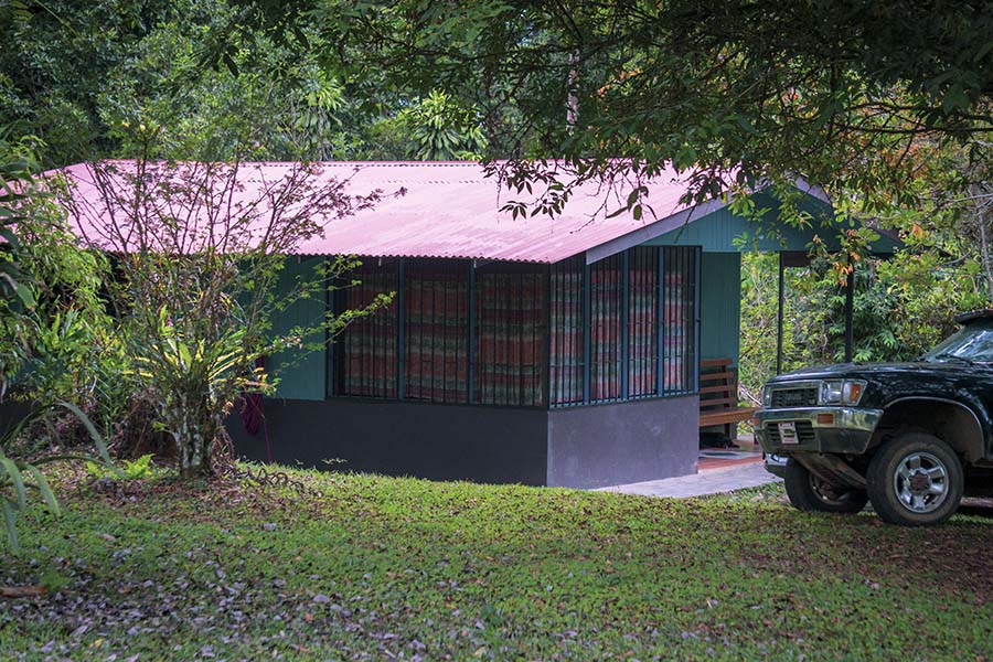
Typical house in Perez Zeledon Southern Costa Rica

Our cottage

During our recent trip to Southern Costa Rica, we stayed in Quizarra, hosted by a local Canadian expat and his Costa Rican neighbors Rocio and Pancho (who also have a cabin for rent next door). The house was fairly simple but had everything we needed for a good level of comfort. There was also a network of trails (with hikes) around the “farm” and a few of bird-feeding stations for observations around the house. One of the afternoons, we walked through the forested area, the remaining pasture land, all the way to the Pena Blanca River (where one can take a refreshing dip on a warm winter day).

Quizarra Dining

If you have self-catering in mind, you can stock on groceries in San Isidro del General or along Route 2. For dining out, there is a plenty of small and inexpensive eateries and cafes in the city. In Quizarra itself, your options will still be limited when it comes to dining. However, there is a couple of bakeries within walking distance from Los Cusingos. They are selling a wide variety of tasty pastries, freshly baked bread and coffee. We opted for spending more of our vacation time outdoors, rather than chasing dining places in the city or cooking our own meals. If this is your preference too, seek out lodging opportunities which offer home-cooked meals for their guests. Dona Rocio, our host’s neighbor, was preparing delicious traditional Costa Rican meals for us during our stay in Quizarra (breakfast $7, lunch and dinner ($10)).

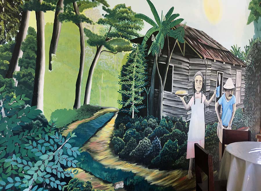
Local Bakery in Quizarra near Los Cusingos

Mural art on a bakery wall in Quizarra

Weather in El General Valley

During the dry season (December-April), the temperatures around San Isidro del General are very pleasant and there is little precipitation overall. Precipitation is the major seasonal weather variable in the region. It is on its lowest in February, with an average of 20 mm. September and October, are the rainiest months with precipitation of 400-500 mm on average. Nights are generally cool, whereas days are warm (but nor oppressively hot, as along the Atlantic and Pacific Coasts). On average, temperatures fluctuate between 62°F at night and 83°F during the day (16-29°C). This pattern remains largely stable throughout the year.

In the Heart of Alexander Skutch Biological Corridor

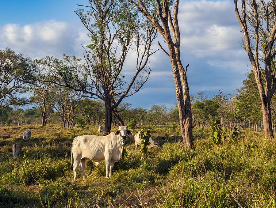
In the second half of the 20th century, most of the “low elevation premontane forest” around Quizarra have been cleared for agriculture and cattle ranching. This had dramatic impact on the local flora and fauna. There are environmental projects aiming to “repair” the continuity of wildlife habitat, fragmented by pastures and agricultural land. Los Cusingos Refuge is an important part of the Alexander Skutch Biological Corridor, which is one of 44 existing biological corridors in Costa Rica. By re-connecting the isolated patches of land, one would make more territory and resources available for native plants and animals. There are ongoing efforts to integrate ecotourism to ease agricultural activities. The idea is simple, but also ambitious. Attracting nature-lovers to Quizarra would economically support the livelihoods of the local people. It will make them less dependent on environmentally destructive farming practices and, thereby, promote nature conservation.

Cattle on a pasture at the foot of Talamanca Mountains in Costa Rica

Pastures of Valle del General

Other Things to Do in and around Quizarra

There is plenty of things to do in the San Isidro del General region.

  1. Given the richness of the local avifauna, you can easily spend two mornings bird-watching in Los Cusingos (one with a local guide and one independently).
  2. We also spent a full day hiking the trails of the nearby Cloud Bridge Reserve. Located in San Gerardo de Rivas, it is just within one-hour drive from Quizarra. This private reserve also organizes birding trips and nature walks for its guests
  3. Finally, you can use Quizarra as a base to visit the Parque National Chirripo. Its entrance is located along the road to the Cloud Bridge Reserve. If you are looking for a challenge, a hike to Cerro Chirripo, the highest mountain peak in Costa Rica (12,530 ft/3820m) might be something to consider. This trip would require two days of your time, with an overnight stay in the park’s only camp. The remote area of Parque National Chirripo is famed for its vistas over the Atlantic and Pacific Oceans and as the coldest place in Costa Rica, with sub-zero temperatures down to 15°F (-9°C) recorded in the past.
Can You Drive the Gap of Dunloe?

Can You Drive the Gap of Dunloe?

It takes about 45 min – 1 hour to drive a car though the Gap of Dunloe, which is about 18 km long. But you have to time it right.

The pass runs through a picturesque glacial mountain valley between Kate Kearney’s Cottage and Moll’s Gap and is a paved PUBLIC road. In fact, you have a choice of driving it in both directions (either south or north), because it’s a two-way road. You can also drive the Gap of Dunloe as a portion of the entire Ring of Kerry, all in just ONE day. We did it during our recent trip to Western Ireland and Scotland, because we only had 2 weeks for the entire trip. To learn more, scroll to the end of this post.

Why drive through the Gap of Dunloe

  • Saving time and money (for a pony & trap, boat trip, taxi & coach etc.)
  • Avoiding the need to walk or bike
  • Staying warm and dry on a rainy day

All valid points! But there are caveats and TIMING is EVERYTHING for taking a car through the place.

Before you hop in the car and take off, consider all “pros and cons” of DRIVING through the Gap of Dunloe. There are other, potentially more enjoyable, alternatives to explore the area. How you drive, walk or cycle through the valley is outlined below.

Entering the Gap of Dunloe by Car at Kate Kearney’s Cottage

As you enter the Gap from the north at Kate Kearney’s Cottage, there is a big sign saying “Traffic primarily restricted to horse & trap, ponies, walkers, residents’ access to accommodation & business purposes”. This is the starting point for the most organized and semi-guided excursions through the Gap of Dunloe. Technically, car travel is legal on this road, as there are some residential dwellings and hospitality sites throughout the valley.

However, car travelers, who ignore the signage during the “busy hours” (10am-2pm), can expect the local jaunting car drivers to give them a hard time and an evil eye. The sign and the presence of a large tourist crowd at that time of the day might give you a pause and make you park at the entrance.

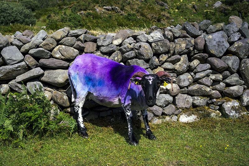
A sheep grazing along the road

A sheep grazing along the road

Why NOT drive the Gap of Dunloe

  • The road is very narrow (mostly one lane) and pedestrian/horse carriage traffic is dense (particularly between 10am-2pm on summer days and on weekends). It can be difficult to maneuver, especially if you are not used to the left-side driving
  • Under these conditions, it is difficult to marvel the scenery, especially for the driver. Stopping along the way to enjoy the views or to take photographs without creating bottlenecks for others might also be problematic
  • Finally, if you cherish traditions (and this is a long-standing one) and would like to support local businesses, non-motorized sightseeing of the Gap of Dunloe would be a natural choice. Already 250 years ago, tourists visiting this area of an incredible natural beauty were following the same travel ritual as they do today. It consisted of walking or riding a pony through the narrow glacial pass and rowing a boat (motorized nowadays) back to Killarney through “the three lakes”.

A Bit of Local Tourism History

The Gap of Dunloe and the neighboring Killarney National Park have been popular tourist attractions since mid-18th century. In fact, the first guidebooks of the area were published in both Dublin and London already in 1776. I remember reading an Irish Naturalist report written in 1893 about the local mountain tourist guides operating in this glacial valley and “presenting” “the true Shamrock” in flower to summer travellers. While the jury is still out on which trefoil clover species (Trifolium minus,T. repens, T. pretense etc.) was the actual prototype for the iconic Irish symbol, the Gap of Dunloe remains a magnet for international and domestic travelers.

Whereas the early-days visitors found the 190 mile-trip from Dublin ‘long and fatiguing’, the railway connection between the capital, Cork and Killarney in mid-19thcentury drastically changed the accessibility of this region within Ireland and from the Great Britain. In 1910, this picturesque gorge overhung with rocky cliffs was picked by the New York-based Kalem Company as a site for one of the FIRST American movies shot “on location” outside of the United States. Predictably, the title of that film was the “Gap of Dunloe”.

For enthusiasts of local history, two interesting reads can be recommended. “The Legend of Kate Kearney’s Cottage” is about Kate Kearney famed for her beauty and illicit poitín (along with goat’s milk!) she was serving to the 19th century tourists. “The Legend of Lord Brandon’s Cottage” is a somber tale of the Lord Brandon’s unfaithful young wife and her life under house imprisonment. Both stories are based on recent research of two Killarney women, Eileen Murphy and Janet Chamberlain.

The Most Popular Tourist Routes via Gap of Dunloe

These days (just like 250 years ago!), most people visiting Gap of Dunloe do so through organized tours from Killarney. These excursions have to be booked in advance.

  • Take a coach from Killarney to Kate Kearney’s Cottage (20-30min to ride this 12 km section)
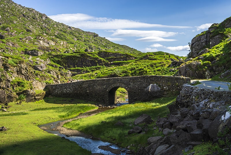
  • Hire a traditional pony and trap (also called jaunting car), walk or cycle. The distance between Kate Kearney’s Cottage to the Head of Gap of Dunloe is 4.3 km and should take about one hour to walk. A little over 1km down the road before the Black Lake, you’ll reach the postcard-worthy stone Wishing Bridge (do not forget to make your wish while crossing!). If you want to catch a boat back to Killarney, you must make it to the Lord Brandon’s Cottage (additional 7 km). The total distance between the Kate Kearney’s Cottage and Lord Brandon’s Cottage is around 11 km (2-2.5 hour walk). The views along this route are spectacular, and you will pass several lakes (including Cosaun, Black, Cushvalley and Augher lakes) connected by the river Loe.
  • If time allows, have a lunch by the Lord Brandon’s Cottage
  • Ride a boat (most leave around 2 pm and take one hour to cross) over to the historic Ross Castle, following two rivers and three lakes (Upper, Middle and Lower Lakes). This section of the trip is popular for its scenic views of the local Killarney oak forests, isles and mountains

You can also travel the route above in reverse from the Ross Castle through the Gap of Dunloe, the Kate Kearney’s Cottage to Killarney.

Finally, you can ride a boat both ways between Ross Castle and Lord Brandon’s Cottage, which would leave ample time (3-4 hours) to explore the gorge on foot or by bike (which can be brought on board, if desired) from the Head of Gap of Dunloe.

All these travel options must be booked IN ADVANCE with travel companies, most of which operate out of Killarney (Deros Tours, Killarney Day Tours, just to name a few).

Resist the temptation of booking your tour too far in advance (until you have a more accurate local weather prediction for the area). Irish weather is always a gamble and the famous Mark Twain’s quote about New England “if you do not like the weather, wait for a few minutes” seems quite fitting for the Western Ireland. However, the general weather trends might be more apparent closer to the date of your visit. On a misty day with poor visibility, you would be better off spending time visiting an indoor attraction (the Hunt Museum in Limerick was on our list). Luckily, the weather Gods were smiling upon us during our trip to the Gap of Dunloe!

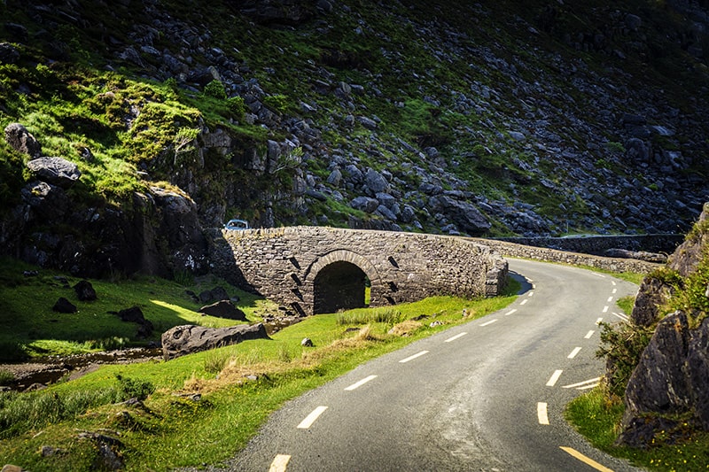
Wishing bridge in Gap of Dunloe County Kerry

 Road over the Wishing Bridge, Gap of Dunloe

Cycling through Gap of Dunloe

You can also travel through the Gap of Dunloe on a bike if cycling is your “thing”. The simplest is to bring your bike all the way to Kate Kearney’s Cottageand cycle to the Gap and back (8.5 km total). Alternatively, you can take your bike on a boat from Killarney and complete the loop through the northern entrance. There will be a stretch of about 12 km on a busy narrow public road back to Killarney.

If you are looking for a challenge, consider a full 56 km bike loop starting from Killarney through the Gap of Dunloe, Molls Gap and Ladies View, recommended by KerryCycling. This is described as “Intermediate to Straining” (2/3 out of 5 or 8 out of 10 difficulty level, by different accounts. Upload the bike route map and learn other details here

Driving Ring of Kerry and Gap of Dunloe in One Day

If you only have one day (like we did) in County Kerry and would like to do both the Ring of Kerry and the Gap of Dunloe, you can certainly do it (especially on a weekday or outside of a busy tourist season). As mentioned above, driving a car would keep your schedule flexible and free of burden to make prior arrangements (for a boat and coach rides) with the tour companies.

Start your Ring of Kerry trip from Killarney early in the morning (well before 10am). Most traffic goes counterclockwise, which local authorities also encourage to avoid accidents and congestion. With a couple of stops along the way, you should be able to reach the Molls Gap around 3-4pm. From here, there is about 18 km north to the Kate Kearney’s Cottage. Enter the narrow, winding road to the Gap of Dunloe, from R568 just before the Loughbarfinnihy lake (you’ll see a sign about traffic restrictions for busses). Follow it all the way to the Kate Kearney’s Cottage on the other end of the gorge.

When driving this route, it’s not unusual to “get lost” in the Black Valley. Checking on your location periodically with Google Maps might help you navigate at “the crossroads” (there is a couple of small intersections along the way).

By the time you reach the head of the Gap, most visitors will be done for the day and the road will be much easier to” negotiate”. We only encountered a few small groups of hikers, a couple of horse carriages and 4 cars (2 in each direction) during our drive. The entire car ride through the Gap of Dunloe from the Moll’s Gap took us 45 min (including two brief stops for taking photographs).

The day of our trip, we had enough time to drive the entire Ring of Kerry (via Gap of Dunloe) from Castlemaine (near Dingle Peninsula) to Limerick. We did make several stops, for lunch and short walks, and arrive to Limerick well in time to have a dinner with live music and dance at a local water hole (The Locke’s Bar).

Would we do it differently today?

If we knew what we know today, we would probably plan on spending an additional day in the area for a separate excursion to the Gap. This would make our trip more meaningful and memorable. If you only have one day in County Kerry and the weather is good (not raining, that is), consider skipping the drive around the Ring of Kerry altogether. Go on a traditional day tour through the Gap of Dunloe instead.

Two-Week Driving Tour of Western Ireland and Scotland

Two-Week Driving Tour of Western Ireland and Scotland

Visiting Ireland and Scotland in One Trip

Getting a glimpse of the remote parts of Ireland and Scotland in 2 weeks is not exactly a relaxing vacation, but it is doable. Be prepared to do a fair amount of left-side driving on skinny, often single track, roads.

Ireland and Scotland may appear close to each other on the map. However, time-effective travel to both countries in just 2 weeks will inevitably pose a few logistical challenges. We spent a significant amount of time on planning the driving route ahead of our trip, but still ended up tweaking it on the go.

The low-cost airline Ryan Air and its offerings of several flights daily between several major cities in both Ireland and Scotland helped greatly in our planning. If we wished, we could even bypass the capitals all together. However, we decided to soak up the urban vibes of Dublin and Edinburgh as a part of our road trip experience in Western Ireland and Scotland.

Planning Your Road Trip

Ireland and Scotland are not vast countries. The distances are relatively short and the road infrastructure is generally good. However, if driving all day long is not your idea of a vacation, spend some time planning a route, which would fit your travel preferences. With the itinerary below, we were able to see most of the coastal Western Ireland. In addition, we also had ample amount of time for daily “communions” with nature, pub crawls and restaurant sit-down dinners.

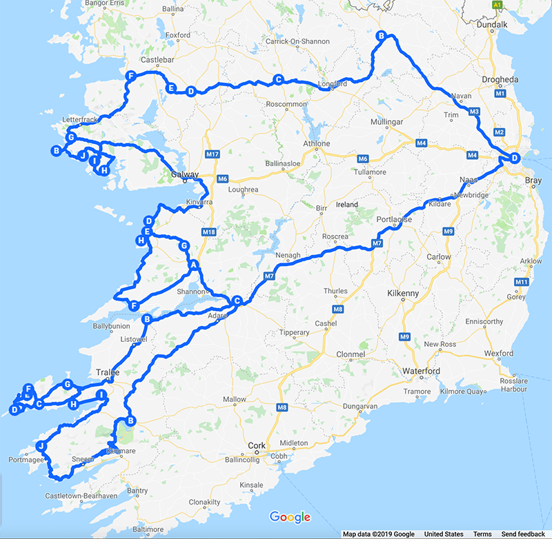
Western Ireland Road Trip Itinerary Map

Western Ireland Road Trip Route

Western Ireland (7-day travel itinerary) 

Drive from Dublin to Cavan (via M3, distance 115 km, travel time 1.5 hr)

Night 1. Cavan

Visit Cavan County Museum featuring a large collection of local artifacts, historic documents and an impressive outdoor exhibit on WWI trench warfare. Stop at a small cafe on premises to connect with the locals.

Take a stroll along the Main street and enjoy your dinner and drinks at Shades Grill in Cavan Town.

Drive from Cavan to Connemara.  The shortest and fastest way is to follow from Cavan town to Galway (distance 170 km, travel time about 2 hours). Taking the back roads of Cavan, Mayo and Galway Counties would be a much slower, but more interesting alternative.

In the evening, head for Kilkieran for an Airbnb stay and enjoy a pint of local ale and a dinner at  Coyne’s Bar & Bistro)

Night 2. Connemara

Day trip around the moorlands of Connemara

Immerse into the Galway city scene with its lively vibe of a student town.

Night 3. Galway

Loop around through the moon-like limestone landscapes of Burren

Take an afternoon walk to dramatic wave-battered Cliffs of Moher

Find one of the countless County Clare trads with live Irish folk music and singing

Night 4. Corofin (Co. Clare)

Explore the medieval sights of Dysert O’Dea in the morning

Head for Dingle Peninsula via Connor Pass

Enjoy a sunset drive around the Slea Head

Night 5. Dingle Peninsula

Drive the Ring of Kerry and the Gap of Dunloe

Settle in for a dinner with live music and dancing at The Locker Bar in Limerick

Night 6. Limerick

Morning visit to the Hunt Museum

Drive from Limerick to Dublin (via M3, distance 200 km, travel time 2 hrs 15 min)

Take an early afternoon walk through Dublin center

Dine at the historic Village Inn back in Celbridge

Night 7. Celbridge

Leaving Dublin for Edinburgh

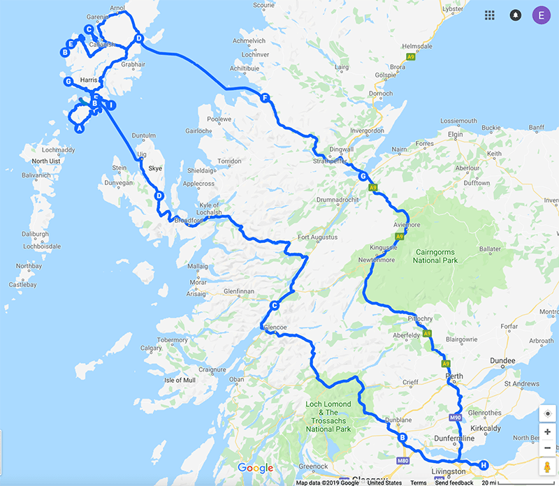
Western Scotland Road Trip Route

Western Scotland Road Trip Route

Scottish Highlands and Outer Hebrides (8-day travel itinerary) 

Drive from Edinburgh to Stirling (via M9, distance 58 km, travel time 1 hr)

Night 1. Stirling

Morning visit to Stirling Castle

Drive through the dramatic landscape of the Glencoe valley to Fort William

Stop in Glencoe village for a short walk along its only street

Afternoon walk and dinner in Fort William

Night 2. Fort William

Drive from Fort William to Uig ferry landing on the Isle of Skye

CalMac Ferry crossing Uig (Isle of Skye) to Tarbert (Isle of Harris) (travel time 1 hr 40 min)

Settle down in Kyles Scalpay or Tarbert on North Harris for two nights

Walk to the Eilean Glas Lighthouse on the Isle of Scalpay

Save a couple of hours for a spectacular sunset drive to Hushinish (along B887) in North Harris

Nights 3-4. Isle of Harris

Day trip around South Harris

Late afternoon or sunset walk along the Luskentyre Beach and dinner back in Tarbert

Explore the beaches of Uig on the Isle of Lewis

Settle down around Uig on Western Lewis for 2 nights

Nights 5-6. Isle of Lewis

Carloway, Callanish Stones, Norse Mill, Blackhouse Village and Stornoway

Visit Bosta Beach and Iron Age House on the way to Stornoway

CalMac Ferry crossing from Stornoway (Isle of Lewis) to Ullapool (travel time 2 hrs 30 min)

Drive from Ullapool to Inverness (via A835, distance 93 km, travel time 1 hr 15 min)

Walk and dinner downtown Inverness

Night 7. Inverness

Drive from Inverness to Edinburgh (via A9, distance 250 km, travel time 3 hrs)

Take a double-decker bus to the Old Town and the Edinburgh Castle

If you visit the capital in August, make sure to order some concert tickets for the legendary Military Tattoo show or another top class performance at the annual Edinburgh International Festival

Enjoy an early dinner on a side street along the busy Royal Mile

Night 8. Edinburgh


Two-Weeks Nature Trip to Southern Costa Rica

Two-Weeks Nature Trip to Southern Costa Rica

We fell in love with Costa Rica (as trite as it might sound) during our first visit 5 years ago. That time, we were based in Uvita, a small settlement in the Puntarenas Province on the Pacific Coast of Southern Costa Rica. Back then, we spent all 10 days exploring the local jungle and secluded beaches, which were within a short walking distance. We also took advantage of multiple high-end gourmet dining opportunities in the neighboring Ojochal. A guided one-day boat trip to the Corcovado National Park and Cano Island (via Sierpe river and Drake Bay) sparked our interest into that corner of Costa Rica. This winter, we were ready for more variety and adventure in the country’s remote South.

Going Back to Costa Rica

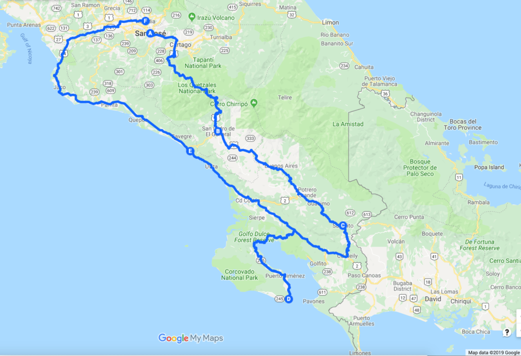
Based on our previous experiences and additional research, we made significant modifications to our Southern Costa Rica trip itinerary. This time, we extended our visit to 15 days (instead of 9) and stayed overnight in San Jose upon arrival and before departure. We also broke up the driving into several legs and stayed in 4 different places along the way. Finally, we did not take the Costal Road (Route 34), which is faster and uncomplicated (and therefore, more popular). We drove Route 2 (Carretera Interamericana) through the Talamanca Mountain Range instead and never regretted that decision.

Southern Costa Rica route

A driving route through Southern Costa Rica

South Costa Rica and Osa Peninsula

2-week travel itinerary


San Jose – 1 night

San Jose – San Isidro del General (via Rt.2). Distance 95 miles, travel time 3-4 hours

Cloud Forest – 3 nights

Quizarra (near San Isidro de El General)

San Isidro – San Vito (via Rt.2 and Rt.237). Distance 85 miles, travel time ~3 hours

Wet Premontane Forest – 2 nights

San Vito

San Vito – Puerto Jimenez (via Rt.16 and Rt.2). Distance 93 miles, travel time ~3 hours

Lowland Rain forest – 7 nights

Osa Peninsula  (Matapalo Beach)

Nature Walks with Lapa Rios Lodge

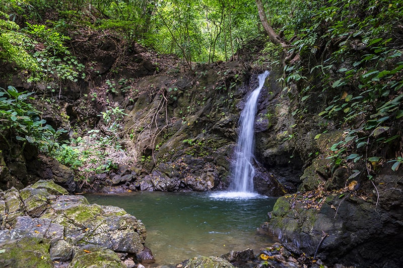
Hike to King Louis Waterfall

Puerto Jimenez – Platanillo (via Rt.2). Distance 110 miles, travel time ~3 hours

Cloud Forest – 1 night

Elegant garden, forest trails and sunset with pina colada at Quinta Heliconia

Platanillo – San Jose (via Rt.34). Distance 140 miles, travel time ~4 hours

San Jose – 1 night

Why visit Southern Costa Rica?

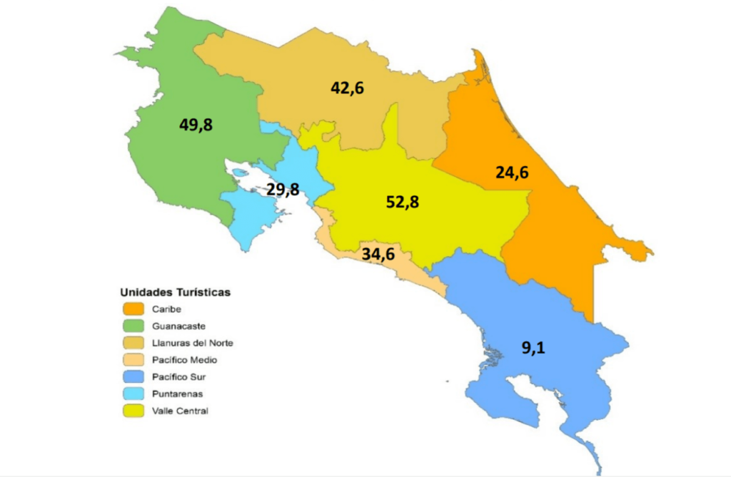
According to the data published by El Instituto Costarricense de Turismo, Costa Rica’s remote South is the least visited part of the country. If you are looking to spend time in a less-traveled secluded areas, this corner of the country would be a natural choice.

Tourist visits (%) to different regions of Costa Rica in 2017. (Source: ict.go.cr).

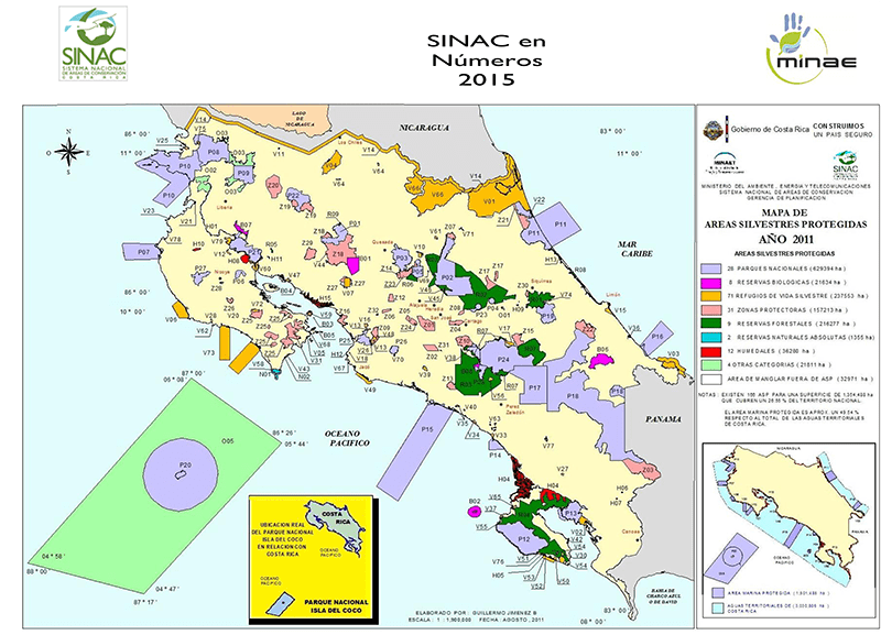
There is another reason for visiting “Pacifico Sur” is the access to a greater number of National Parks and Nature Reserves, including the largest (and least visited) in the nation and the entire Central America (e.g. La Amistad, Corcovado and Tapanti National Parks). If you are looking for seclusion and authentic experience of Costa Rica’s wildlife, avoid the “tourist traps”. Check out the website The Costa Rican Tourism Board (ICT)  to compare the number of visitors recorded for different National Parks and Nature Reserves (see the map below). You will discover that more that a quarter of all visitors end up in the tiny Manuel Antonio National Park! Equipped with those numbers, you can plan your trip according to your preferences for peace and solitude.

National Parks and Nature Reserves of Costa Rica

National Parks and Nature Reserves of Costa Rica (Source: ict.go.cr)

Flying Copa Airlines to Costa Rica via Panama City

During this trip to Costa Rica, we chose Copa Airline as our carrier and did not regret this decision. You can read our honest assessment of the trip in more detail in Flying Copa to Costa Rica. In short, flying via Panama, saved us money and potential headaches of flying the regular routes, which most American tourists take.