Skeleton Coast Plants – More Than Meets the Eye

Skeleton Coast Plants – More Than Meets the Eye

The harsh and uninviting environment of the Namibian Atlantic Coast sparked our curiosity about its plants. On our springtime self-drive trip to the Skeleton Coast National Park, we got surprised by the variety of vegetation found there.

Schematic Map of Skeleton Coast National Park in Namibia

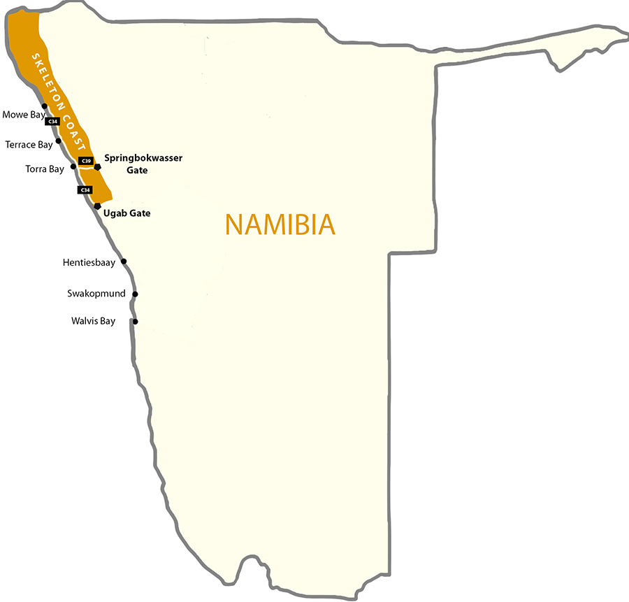
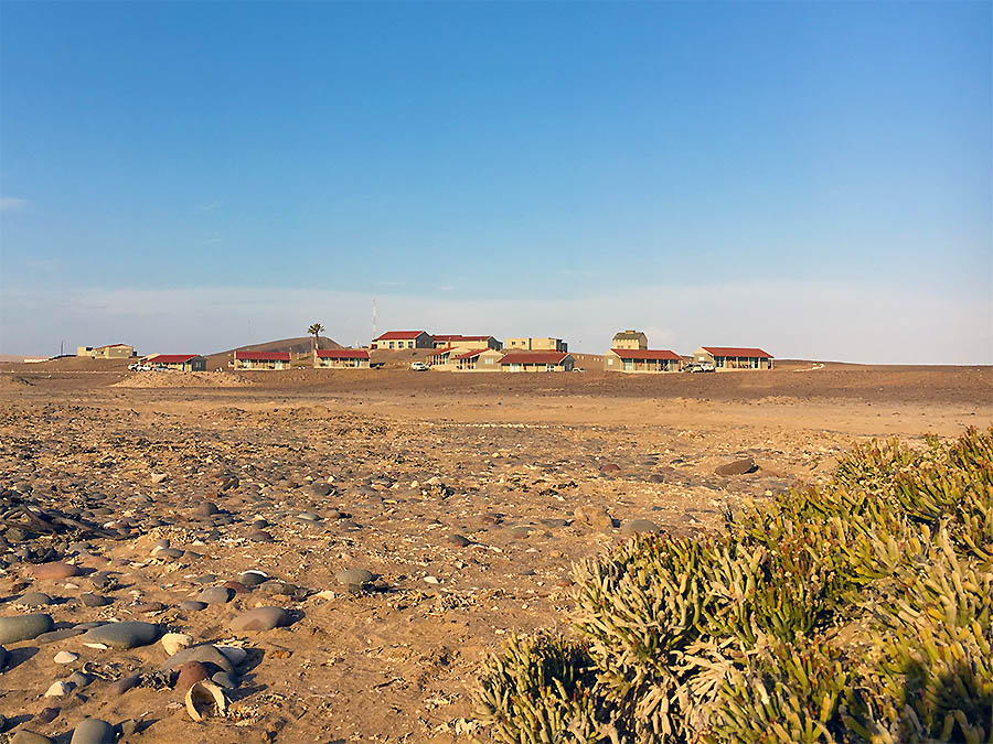
Skeleton Coast National Park Location 

The Skeleton Coast of Namibia is dominated by several unique types of vegetation, each of which thrives in a specific habitat niche:

  • Lichen fields, with over a hundred different species, some of which are rare and range-restricted to this area
  • Salt– and brackish water-resistant dwarf shrubs and small trees abundant along the coast covered by sea salt and periodic salt-pans
  • Seaweeds, with growth rates among the highest in the world, abundant along the coastline and include regional endemics of Southern Africa and the Benguela Marine Province
  • Succulent and non-succulent desert-adopted plants of various sizes
  • Grasses, tall shrubs and small trees common along the ephemeral riverbeds and underground streams
Terrace Bay Skeleton Coast with salt-resistant succulent Pencil bush Arthraerua leubnitziae

Salt-resistant Pencil bush on Terrace Bay

Skeleton Coast Climate and Water Sources

The Namib Desert is one of the driest places on Earth, with an average annual precipitation of about 2 cm along the Skeleton Coast. And some years, it does not rain at all. There are only two other coastal deserts in the world with a similar climate: the Atacama Desert on the Pacific Coast of Peru and Northern Chile, and the Sonoran Desert in Baja California. Unsurprisingly, there are significant similarities in vegetation patterns between those arid places and the Namibian Skeleton Coast. Many of their native plants and lichens also rely heavily on the coastal fog and dew as main water sources.

1. Fog vs. Rainfall

Despite the low to non-existent rainfall, the cold Benguela Current of the Atlantic Ocean by the Namibian shore brings over cool, moist fog on most days of the year (especially in the winter months). This dense atmospheric moisture is pushed further inland by the wind, where it disappears around noontime. This phenomenon keeps the average air humidity levels relatively high, within the Namibian fog belt.

The amount of fog moisture blown by the westerly wind through the coastal part of the Namib Desert is typically between 4-9 cm per year, which far exceeds the average rainfall precipitation (of 2 cm). Coastal fog is a source of not only moisture, but also nutrients. Moreover, it plays an important role in the formation of gypsum crust, which is a critical substrate for the “pioneering” lichen growth. See more information on gypsum-rich soil below.

2. Morning Dew

The annual average temperature on the Skeleton Coast is only 16 °C, with wild fluctuations between day and night. Because of these changes, the dew precipitation is significant in these parts of the world. Like fog, dew moisture is an important direct and indirect (through soil drip) water source for the wide variety of lichens and some succulent plants in this hyper-arid region.

3. Ground Water

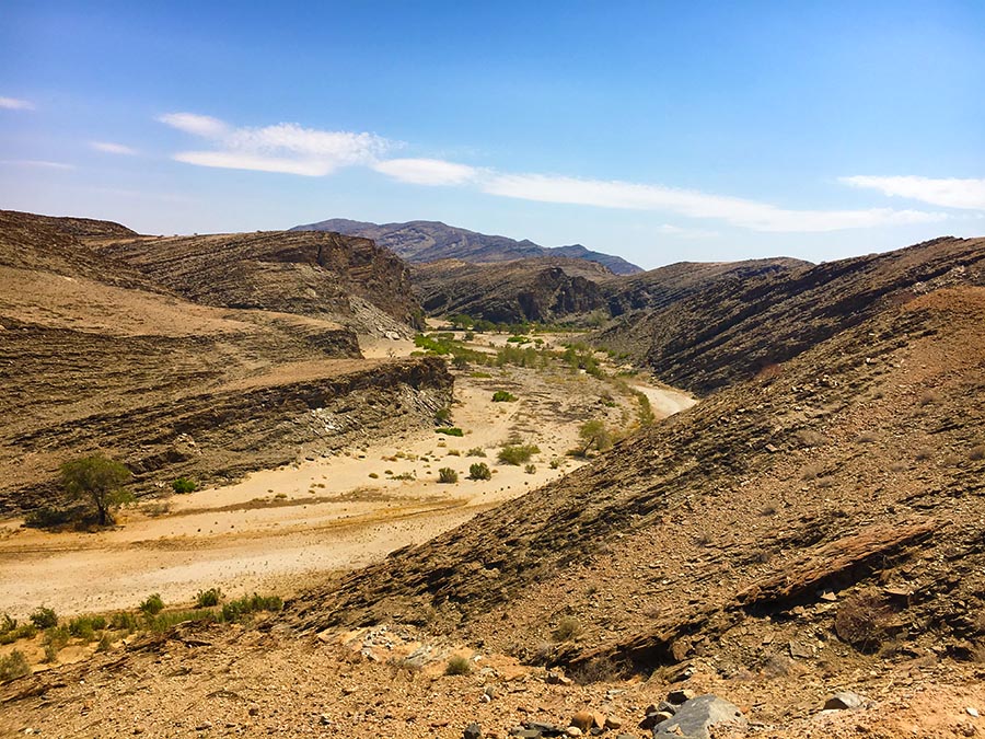
In the Southern Namib Desert, almost no rivers reach the Atlantic Coast most of the year. In contrast, the ephemeral rivers cutting across the Skeleton Coast do form lavishly green linear oases throughout the otherwise desolate coastal desert landscapes. Some of these rivers and streams are completely hidden underground, but the water still sips through the surface bringing the desert landscape above the ground to life. River water is a lifeline for grasses, trees and the browsing wildlife.

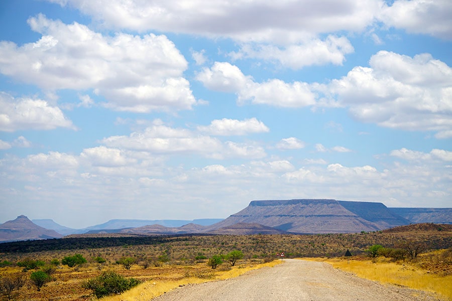
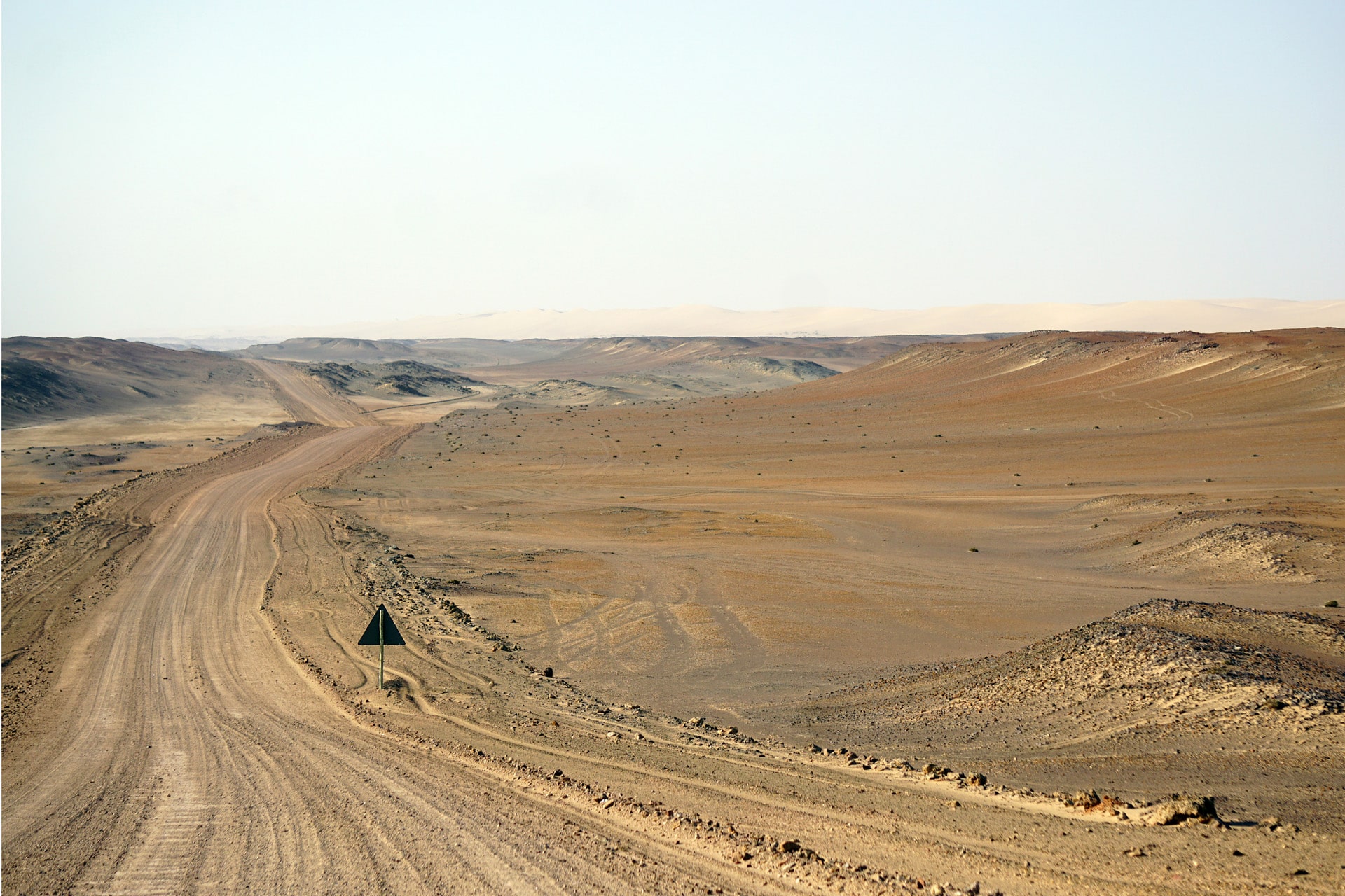
Skeleton Coast Vegetation Pattern

Lichen fields and sand hummocks around desert plants of Skeleton Coast in Namibia

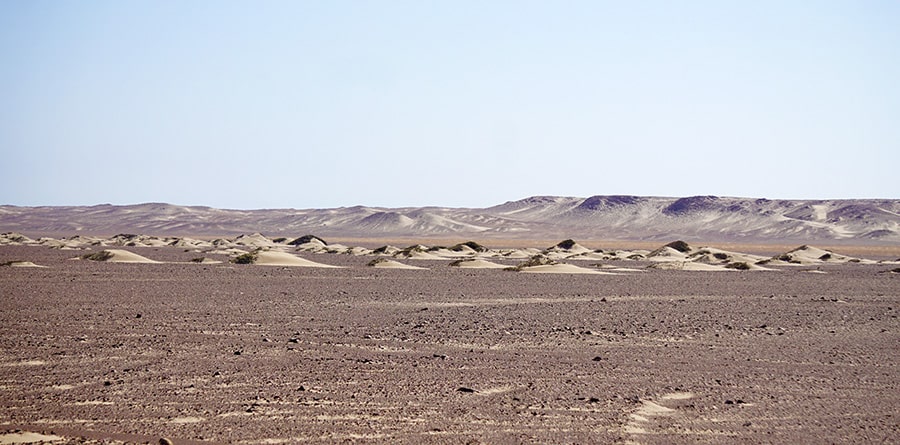
Desert Plants Forming Sand Hummocks

As we traveled along the Skeleton Coast, we noticed that the vegetation varied wildly between the outer coastal areas and its interior. The outer zone of a few hundred meters was covered with low-growing succulent shrubs, such as the Namib endemic Dollar bush (Zygophyllum stapfii). Its Red book restricted-range relative Zygophyllum inflatum grows in the most northern section of the Skeleton Coast Park. Archaeological studies on the Skeleton Coast indicate that Dollar bush plants served as a major source of charcoal for the seasonal settlements of the local Namibian tribes in the past. Following the dry riverbeds, they were coming from the “hinterlands” of the Kaokoland to make use of the marine food resources available by the ocean.

Other salt-tolerant shrubs, such as Ganna or Saltbush (Salsola species) and Pencil bush (Arthraerua leubnitziae) also thrive along the sandy beaches of the Skeleton Coast Park. These plants trap sand particles forming sand hummocks, which provide habitat for local wildlife and form larger dunes over time.

The dominance of lichens throughout the Namib Desert is epitomized along the plains of the Skeleton Coast. Large sand dune-free areas, called “lichen fields”, stretch along route C34 on the Skeleton Coast road. The fog belt, with the moisture not available to most vascular plants, makes for perfect lichen living conditions. They grow on gravel surfaces and gypsum-crusted soil and become dormant (but do not die) when moisture is not available.

Skeleton Coast-Damaraland border landscape and vegetation

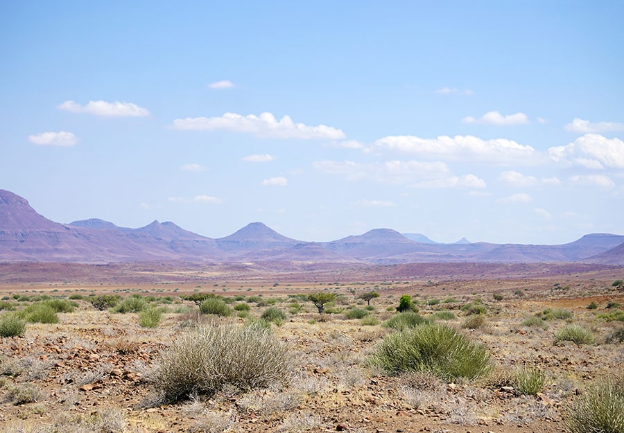
Plants of the Eastern Skeleton Coast

The gravel plains on the eastern edges of the Skeleton Coast are reminiscent of the Damaraland shrub lands, dominated by larger populations of Milk bush (Euphorbia damarana) and a few low-growing trees.

Lichen Fields of the Skeleton Coast

Lichen fields of Skeleton Coast in Namibia

Skeleton Coast Landcape

The ability of lichens to survive on coastal fog and dew alone and to “cycle” between the dormant and active states make them perfectly adopted to the  Skeleton Coast environment. Here, they are rich in species (although many are closely related) and the endemism level is impressive. Still, some species (e.g. Santessonia namibensis) living here are believed to have the smallest distribution ranges of all lichens in the world.

The first descriptions of Namibian lichens were published over one hundred years ago in “Die Pflanzenwelt Deutsch-Südwestafrikas”. Since then, over 100 lichen species living in the Namib Desert alone have been described (if you are looking for a field guide, check out “Lichens of the Namib Desert by Dr. Volkmar Wirth).

Given their microscopic size, the amount of “lichen biomass” along the Skeleton Coast is also impressive. For some “lichen fields”, it is reported being as high as 400 grams per square meter. The biological soil crusts they form in this hyper-arid land makes lichens the key flora of the Skeleton Coast.

Lichen fields are complex and fine-tuned ecological systems. Many environmental factors, such as moisture levels, soil acidity and salinity, availability of stable substrate (sand dunes vs gypsum crust vs gravel) and even its sloping angle determine lichen growth and distribution.

The prevailing winds on the Skeleton Coast shape the pattern of the vegetation cover. If you take a closer look at the lichen-covered rocks, you will notice that the colonies prefer living on the west-facing surfaces. This is because the Atlantic Ocean brings cool moist winds, whereas the winds from the East tend to blast the vegetation without mercy with deadly hot air and sand.

Skeleton-Coast-Lichen-Fields-Namibia-off-road-tracks

Off-road Car Tracks over Lichen Fields 

A lichen fields is also a very fragile ecosystem. Once disturbed by tourist vehicles, it takes decades, if not a full century, for them to recover. Remember to stay on the road when driving through the Park!

Desert sand, which is constantly on the move, does not encourage lichen growth. In contrast, gravel stones littering the Skeleton Coast, and cemented gypsum crust serve as an excellent substrate for lichens.

Coastal fogs play a key role in the formation of the large areas of gypsum-rich soils on the Skeleton Coast. Here is how they are created, in a nutshell: H2S released by the ocean reacts with atmospheric oxygen and forms sulfate, which is then transported inland by the coastal fog, where (in the presence of calcium carbonate) it turns into gypsum (CaSO4·2H2O).

Vegetation of the Ephemeral Rivers

Skeleton Coast Uniab River Vegetation and grazing Oryx antelopes

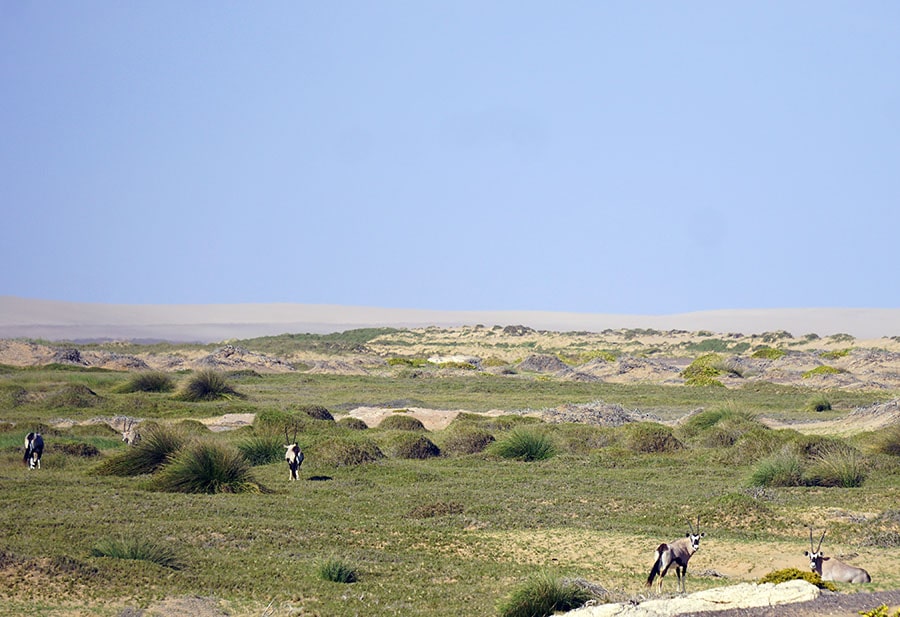
Grazing Oryx by Uniab River Oasis

As we continue driving north, several dry riverbeds cut across the desert landscape. Grasses and taller vegetation, such as wild tamarisk or “salt cedar” bushes (Tamarix usneoides), mopane trees (Colophospermum mopane) and makalani palms (Hyphaene petersiana), become more common here.

Makalani palms, native to Northern Namibia, are easily recognizable by their fan-shaped leaves. During our Skeleton Coast trip, we bought a few makalani palm nuts by the roadside to bring home as inexpensive souvenirs. These cute clumps of “plant ivory” were transformed into small pieces of handcrafted art by some local carvers. You can also find traditional ornamental bowls and baskets hand-woven with makalani palm leaves.

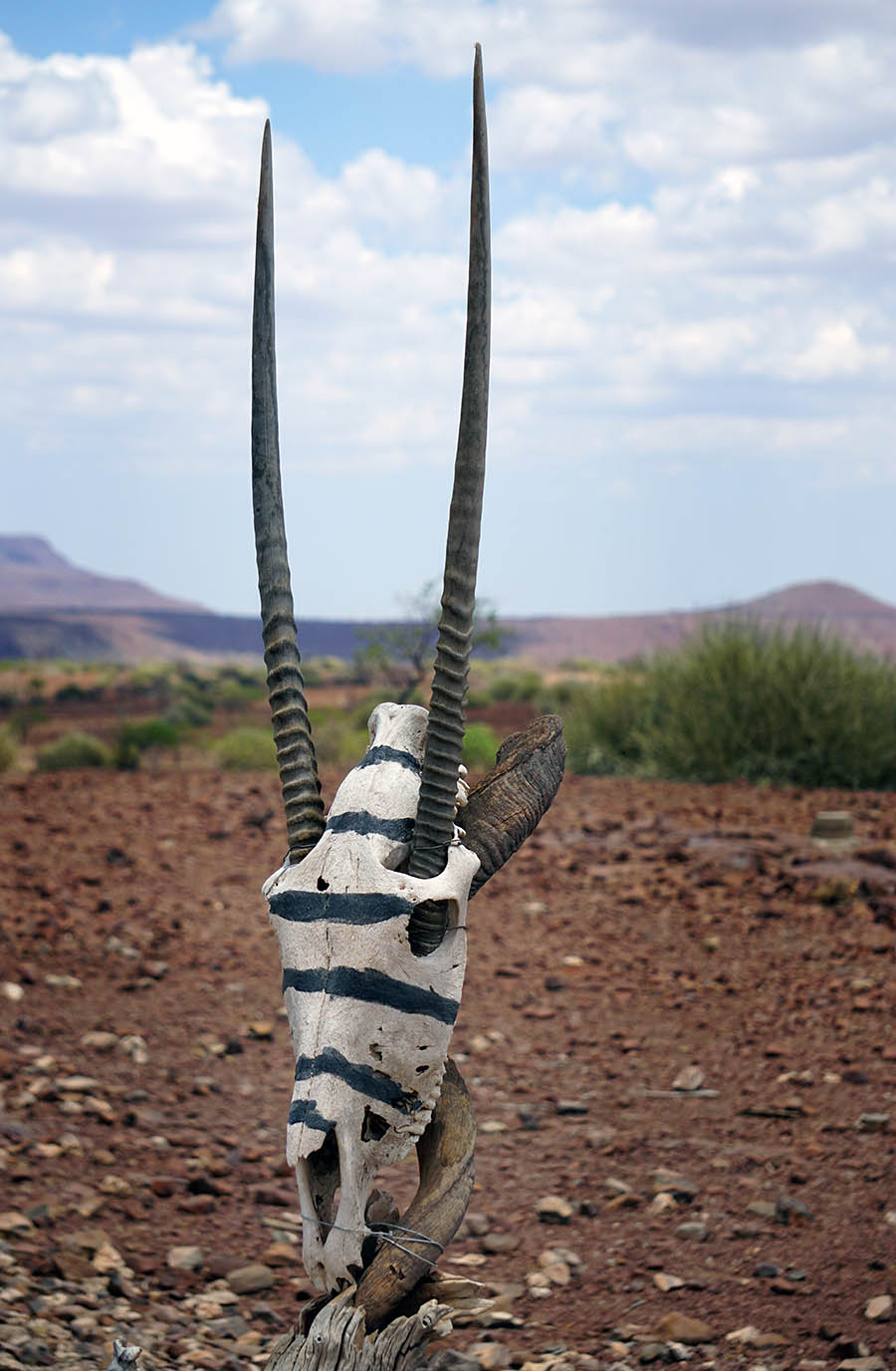
Ephemeral rivers and underground streams are important water sources for the local wildlife. These linear oases offer the best opportunity for game viewing in the Skeleton Coast National Park. You can often spot  springbok and oryx antelopes grazing on lavish vegetation along the riverbeds. But be warned about the lions roaming the area. While staying in Terrace Bay for a night, we were told about these big cats frequenting the coast. You can track their movements around the Obab and other Skeleton Coast rivers on the “Desert Lion Conservation” website.

Skeleton Coast Marine Plants and Seaweeds

Beach cast seaweeds on Skeleton Coast National Park in Namibia

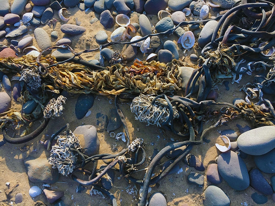
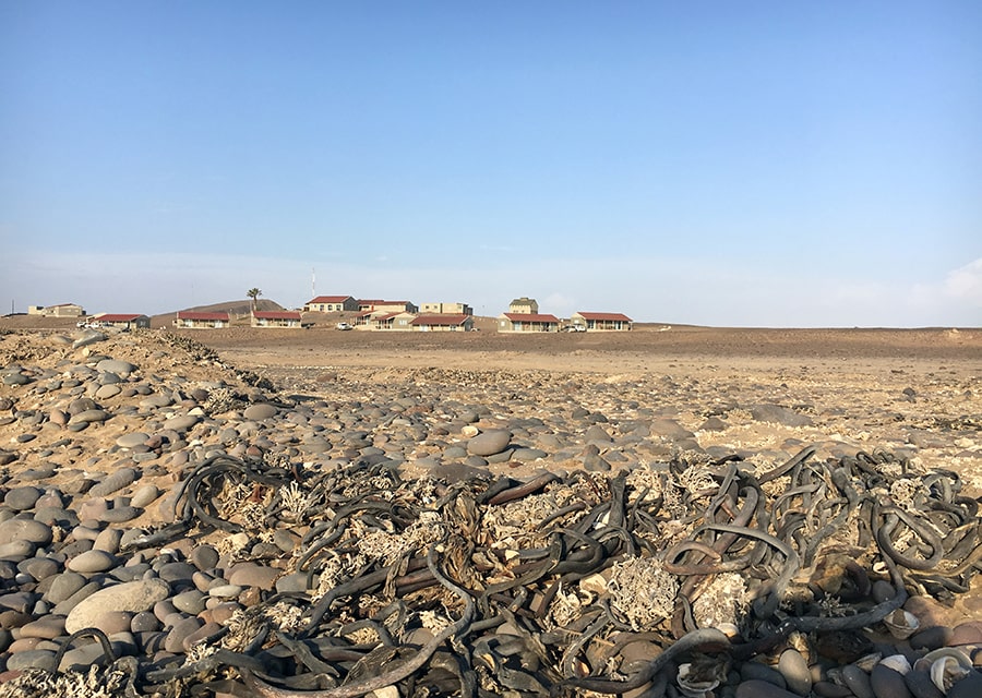
Seaweed Cast on Skeleton Coast

The outer part of the Skeleton Coast National Park is dominated by sandy beaches, with occasional rocky outcrops. The Benguela Current supplies large amounts of nutrients, feeding both marine animals and fields of seaweeds along the coast.

Although the diversity of the local sea flora is not as high as in the neighboring South Africa, it is considerably richer than in Angola and other countries of the West coast of the continent. A significant number the Namibian algae species are considered regional endemics to Southern Africa and the Benguela Marine Province (28.1% and 12.8% of flora, respectively). However, out of 196 described species, Acrosorium cincinnatum is the only endemic algae to Namibia. In addition to Swakopmund area, it has been found in Terrace Bay, Möwe Bay and at the Rocky Point in the Skeleton Coast National Park.

The seaweed variety along the Skeleton Coast features brown (Split-fan kelp or Laminaria pallida), green (Sea Lettuce or Ulva spp.) and red algae (Cape laver or Porphyra capensis, Red ribbons (Suhria vittata)). The epiphytic Yellow skin (Aeodes orbitosa or Pachymenia orbitosa) is more prevalent along the southern Namibia, where, in the sheltered waters, the size of its thallus (“leaf”) can reach 1-1.5 m in diameter. However, it has also been reported at Cape Frio and other locations of the Skeleton Coast.

Check out the “Marine benthic algae of Namibia” article for an overview of the Namibian seaweed variety and their geographic distribution, including those sampled in different locations along the Skeleton Coast.

The growth rate of algae in this part of the Atlantic Coast is one of the highest in the world. Some varieties (Laminaria pallida, Gracilaria verrucose) have been harvested in Namibia for commercial and domestic purposes.

Economical uses aside, seaweeds play an important ecological role along the Skeleton Coast. They serve as both food and shelter for marine and shore animals living in the inter-tidal zone. Swells and wind wash large amounts of seaweeds ashore. These plants decompose and provide nutrients to the soil-deprived sandy beaches, which dominate the Skeleton Coast National Park.

Rare and Endemic Plants of the Skeleton Coast

Nara Melon Plant Skeleton Coast Namibia

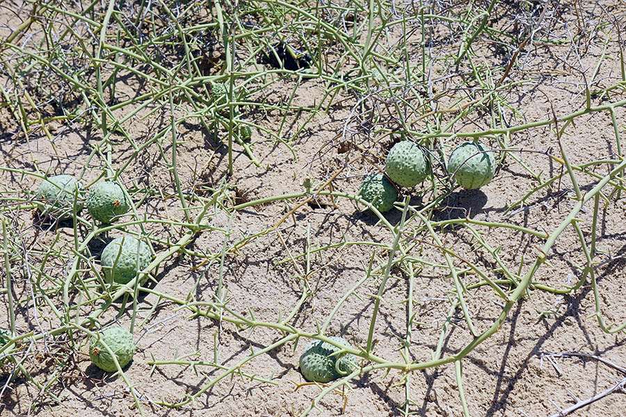
Nara Plant with Fruits

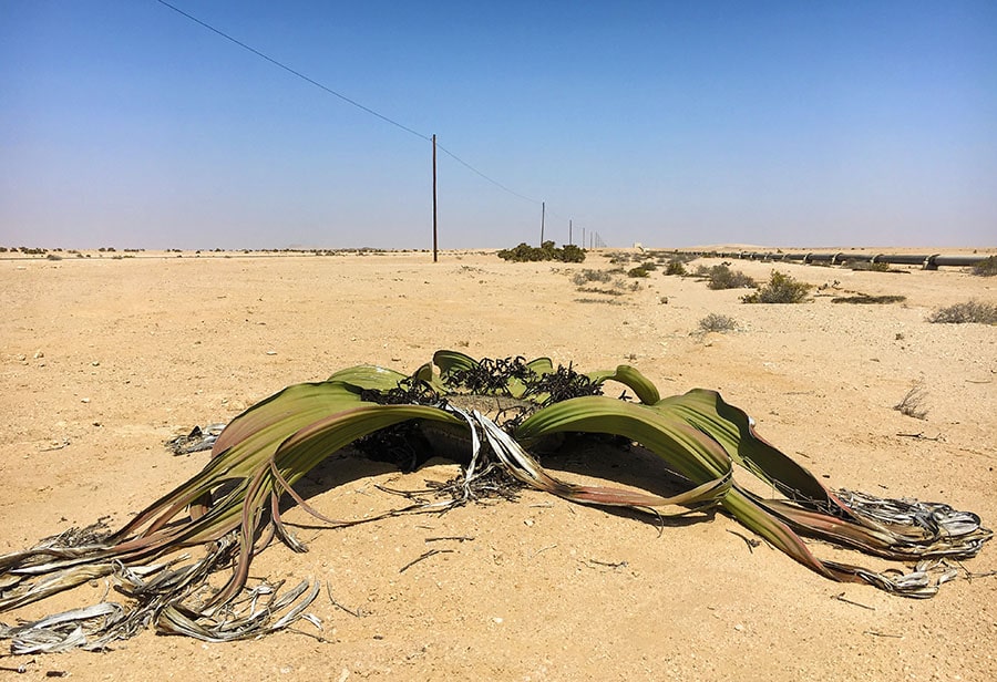
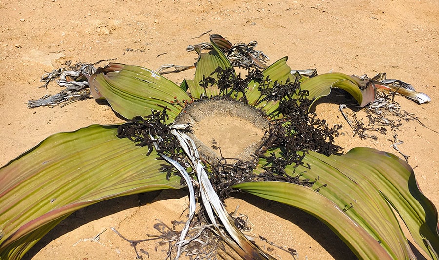
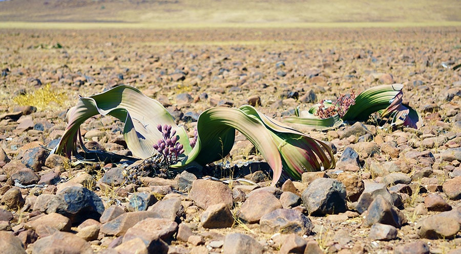
Nara plant (Nara melon or Acanthosicyos horridus) and Welwitschia mirabilis are unusual long-lived perennial plants and are both botanic curiosities of sorts. Despite their Namib Desert endemic status, neither is currently endangered (although Welwitschia does have a “protected” status in the country) because they are well adapted to their environment and are relatively common within their natural habitat.

Nara melon is a dune-growing Cucurbitacean plant, which forms dense bushes with branched light-green spiny stems and pale-yellow solitary flowers. The green fruits are also thorny and turn yellow or pale orange when ripe. They are not true desert plants and grow mostly in areas with underground water sources. Nara plants are far more ubiquitous in the Namib Sand Sea south of Swakopmund (the Sossusvlei and Sandwich Harbor are among the best viewing spots for this ecologically important desert species).

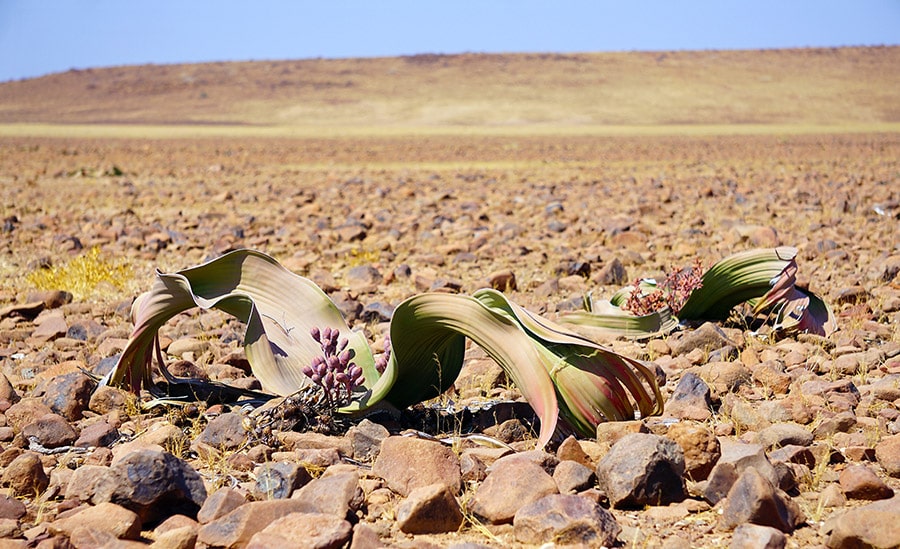
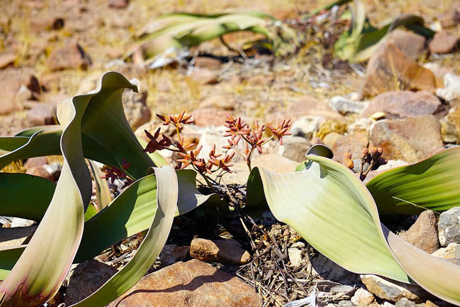
Welwitschia mirabilis is not as commonly seen along the Skeleton Coast as in other parts of Namibia. However, it can be found, if you know where to look. Check out  where wild Welwitschia mirabilis grows post for 2 such locations near Ugab and Springbokwasser Gates of the Skeleton Coast Park.

Male plant of Welwitschia Mirabilis in Namib Desert

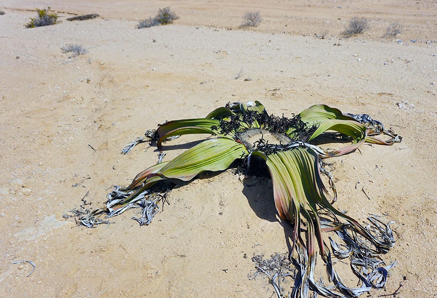
Male plant of Welwitschia mirabilis

The majority of endemic and rare plant species of the coastal Namib Desert grow in the Sperrgebiet area (German for “forbidden territory”) further south. It is a part of a larger Succulent Karoo Region of the Southwestern Africa, one of the few recognized hot spots in the world with exceptional biodiversity.

Nonetheless, several Red Data Book plant species also live along the Skeleton Coast. The list of local endemics includes Aloe dewinteri Giess (Sesfontein-aalwyn), a smaller population of Cyphostemma juttae (a Cissus species) and a larger woody perennial plant Elephant’s Foot (Adenia pechuelii).

The upper part of the Skeleton Coast represents the northern limit of the natural habitat for peculiar dwarf succulents Lithops (Mesembryanthemums, also called “flowering stones” or vygies, locally). These regional endemics live almost exclusively (98% of all species) in the Succulent Karoo Region of Southwestern Africa. A few lithop species found outside of this region are believed to be dispersed and introduced there by shorebirds. Lithops ruschiorum, a Red Data Book endemic with a long-lasting yellow flower, lives in the Skeleton Coast National Park.

Lithops’ very short stem with a couple of thick fused leaves are sometimes barely visible in the sand and pebble ground cover. This peculiar appearance is an adaptation to the extremely dry environment. It allows for a reduction of surface area, while maximizing the leaf volume for water storage.

The most remote northern part of the Skeleton Coast is only accessible with fly-in tourist operators. In addition to the rare plants mentioned above, “cactus-like” stapeliads Hoodia currori, towering over the desert landscape, and Hoodia pedicellata (Trichocaulon pedicilfatum) can be spotted there.

This is also the natural habitat for the Namibian population of Adenium boehmianum. This plant is also called Bushman Poison, because the Heikom Bushmen apply its poisonous sap to their arrowheads for game hunting.

Unfortunately, poaching by succulent collectors and commercial dealers represents one of the biggest threats to these rare plants. You can learn more about Namibia’s threatened or endangered plants from this well illustrated on-line book “Red Data Book of Namibian Plants”

Where to Find Wild Welwitschia mirabilis in Namibia

Where to Find Wild Welwitschia mirabilis in Namibia

The Welwitschia Plains near Swakopmund and the Coastal fog belt of Damaraland are the areas with most reported sightings of Welwitchia mirabilis since its discovery in Namibia. Below is an abbreviated map and detailed descriptions of 5 specific locations in Namibia, where you can find larger populations of Welwitschia plants in the wild. Most of them are based on our own sightings during the Unexpected Trip to Africa.

Discovery of Welwitchia mirabilis in Namibia

In September 1859, an Austrian botanist Friedrich Welwitsch made the first documented discovery of a new remarkable plant living on an elevated plateau near Cape Negro in Angola. He shared his findings with Dr. William Hooker, the director of the Royal Botanic Gardens, Kew at the time.

Shortly after, 500 miles south, Thomas Baines, an artist who was accompanying Dr. Livingstone on an expedition to the Zambezi River, drew several colored sketches of a big mysterious plant he found in the Namib Desert. Along with a few cones and leaves he collected, Baines sent his drawings of the “strange giant aloe” to William Hooker as well. This marked the official discovery of the “marvelous plant” Welwitschia mirabilis, in Namibia.

Today, you can see an oil painting created by Baines based on his original sketch at the Kew Library. Its caption reads The Welwitschia mirabilis or Nyanka Kykamkop plant of Hykamkop, South West Africa. T. Baines. May 9 1861”.

Where to find wild Welwitschia mirabilis in Namibia

Map of the best viewing locations of Welwitschia mirabilis in Namibia

Welwitschia Mirabilis Natural Range and Distribution

Welwitschia mirabilis is a regional endemic of the Coastal Namib Desert. Its natural range extends over an area of 150,000 square km along the southwestern coast of Africa from the Kuiseb River (the Tropic of Capricorn) in central Namibia to the Bentiaba River in southern Angola. Its preferred habitat appears to be hyper-arid gravel plains or gypsum-rich soils.

The prominent Swedish explorer of Namibia Charles Andersson was writing in his notes “It is most common about the lower course of the River Swakop”. He also mentioned that it was growing in “the ground of hard quartzose character, and generally near little ruts worn in the plain by running water in the rainy season”. In 1862, the first living specimen of Welwitschia mirabilis was planted “with its native soil in a flour barrel” and shipped with a mail-steamer to join the botanical collection at Kew.

Below are five best locations in Namibia to see a variety of wild Welwitschia mirabilis plants growing within distinct, but equally natural habitats (numbered as on the map above).

1. Welwitschia Drive

The location the explorer Charles Andersson was referring in his early notes is believed to be Welwitschia Plains (also called Welwitschia Flats or Welwitschia Fläche). It is the most popular and widely advertised site in the Central Namib Desert for viewing Welwitschia plants. Situated between the Khan and Swakop rivers, it is a part of the Namib-Naukluft Park and has an easy access both from Swakopmund in the west and Windhoek in the east.

Welwitschia plains near Swakopmund Namibia

Typical landscape of the Welwitschia Plains

A permit, which can be obtained in Swakopmund, is required to access the Welwitschia Plains. With this permit, you will also receive a hand-drawn map of the Namib-Naukluft Park containing the small section dedicated to the Welwitschia Drive.

The tourist route from Swakopmund through Welwitschia Plains is called Welwitschia Drive. The round trip is 160 km and takes about 3-4 hours to tour with stops. It is an arid and barren place, but the area by the Swakop river provides some shade and is equipped with picnic tables and even campsites for overnight stays if desired.

You can download and bring along the official “The Welwitschia Plains – scenic drive” brochure, which includes a map and descriptions of all “attractions” along the route. Look for 13 labelled stone beacons. At the end of the Welwitchia Drive at the turning point, markers 11 & 12 will indicate the highlight of the trip, a larger group of very special Welwitschia (some female and male plants are marked with respective signs).

Male welwitschia plant along the Welwitschia Scenic Drive

The Swakopmund location along the Welwitschia Drive boasts the oldest known plant colony, some of which are of remarkable size. The two largest Welwitschias (both female plants) in existence are growing here. These are also the oldest living Welwitschia plants, with an age of 1500 years (as estimated by carbon dating).

Chris Bornman details the enormous size on these peculiar plants in his article “Welwitschia mirabilis: paradox of the Namib Desert”: “The two tallest plants known, the Husab Welwitschia and the Pforte Welwitschia are 1.5 m and 1.9 m from the base to crown, respectively. The latter plant occupies an area 9.1 m in circumference and its stem, measured along the terminal groove, has a circumference of 5.7 m”.

Local mining activities resulted in excavation of some old Welwitschia plants in the area. This facilitated a study of their root system and the water sources. It showed that, contrary to a belief, the tap root was not all that long and did not measure more than 3 meters. Based on these and other observations, it was concluded that Welwitschia plants cannot rely on access to the ground water at 50-75 m depth for water supply.

2. Mine Hope and Welwitschia Wash on Kuiseb River

The Kuiseb River in Dry season - the view from the Kuiseb Pass

View of the Kuiseb River in dry season

The Tropic of Capricorn is the most southern frontier of Welwitschia mirabilis natural habitat range. This community of plants is little off the most popular tourist routes in Namibia, but it may be more accessible if you plan to visit the Gobabeb Research and Training Centre (GRTC). The Center, which is located about 120 km southeast of Swakopmund, has dedicated numerous studies of the Gobabeb population of Welwitschia mirabilis.

These plants are concentrated in tributaries of the Kuiseb River, 15 km (in the Welwitschia Wash) and 30 km (near the Hope Mine) from the Research Center. Apparently, you can make a reservation for your stay in the area by directly contacting the GRTC.

Welwitschia Plants of Damaraland

Unlike Welwitschia Plains near Swakopmund, the Welwitschia locations of Damaraland and the neighboring Skeleton Coast are not widely advertised. This may be because many of these places are more remote and some are notoriously difficult to get to. Below are the three areas in the Damaraland you might wish to explore in search of Welwitschia mirabilis.

Damaraland landscape

Damaraland landscape

3. Welwitschia of Brandberg and Messum Crater

Amid vast desert plains, 250 km north the Welwitschia Drive, there is a granite massif with Namibia’s highest peak, the Brandberg Mountain (2,573m). It is at the foot of this mountain, Willie Giess (a botanist who was mapping Namibian plant communities back in the 1970s) found the largest Welwitschia plants ever recorded. Reportedly, he described a plant with a stem height of 1.8 m and another one with a stem diameter of 4 m near the Messum Crater (a large volcanic depression in the ground) west of Brandberg. However, some publications indicate that those giants since then burnt down by the lightening fire.

Unique Welwitschia plants with extra leaves (3-4, instead the usual 2) were also reported around here by Dieter von Willert in 1993. Two distinct types of extra-leafed Welwitschia were described in “Can Welwitschia mirabilis have more than only two Foliage leaves?”.

The first type had an additional pair of opposite leaves breaking through the top of the stem (more than a dozen of these were found among the 300 plants examined). The second variety had a single additional leaf. A group of nature enthusiasts on a follow-up “expedition” to this area in 2001 confirmed these findings. You can read their own account in “Torn to Ribbons in the Desert”.

A check list of 490 vascular plants living in the area (including Welwitschia mirabilis), can be found in The flora of the Brandberg, Namibia.

The Brandberg and Messum Crater area is best accessible via D2342 and D2303, off the Skeleton Coast road C34. Both D-roads are in a relatively good condition and are passable by a 2WD (although renting a car with higher clearance is advisable in these parts).

This amazing travel blog describes an adventurous 3-day journey of a biker along the same route (albeit in opposite direction) D2342 and D2303. There are also numerous photographs of the area, including those of the Brandberg Welwitscha population.

Ugab River Rhino Camp near the D2342-D2303 junction is the only place in the area where you can camp. However, you can visit the area as a day trip from Hentiesbaai (if you start early) or better yet from Cape Cross on C34.

Driving along the northern section of D2303 over the Ugab River is not recommended for independent tourists even by a 4WD. It is easy to understand after you hear the story about a well-travelled Dutch couple, Jan Snel and Mieke Schrijver, who got lost in that remote Burnt Mountain region of Damaraland and ran out of fuel in the late April 2003. They were stranded there without water for over two weeks. By the time they were found, Jan Snel died of dehydration and his wife was barely alive.

4. Welwitschia on the Fringes of the Skeleton Coast

Welwitschia grow along roadside of C39 just before you exit the Springbokwasser Gate of the Skeleton Coast National Park (30km from the Atlantic Coast). Curious about other unique plants along this route? Read the Skeleton Coast Plants post.

As you continue along beyond the Gate, a scenic view over the gravel plains opens up with numerous additional opportunities to get spectacular local welwitschia plants in the frame with the mountains of the Great Escarpment as a backdrop. These plants are “fed” by the water provided by the Koigab River, which “runs” faithfully along the road.

Male and female Welwitschia plants on gravel plains of Damaraland

If you keep driving for another 125 km on C39 (about 2 hours) from the Skeleton Coast National Park), you will be able to admire Welwitschia plans thriving in a different natural environment of the mopane savanna.

5. Welwitschia in Mopane Savanna near Khorixas

This unique population of Welwitschia plants grows along C39 west of Khorixas in Damaraland. The mean annual rainfall (150–200 mm) is significantly higher here than in the other Namibian Desert Welwitschia habitats described above.  This is mopane savanna dominated by extensive grass cover, small shrubs and mopane trees.

If you are headed to see the Petrified Forest (45 km west of Khoraxis on C39), you won’t be able to miss the local Welwitschia growing there. They can be spotted rooted in sandstone right next to the 250 million years old fossilized pine trees, which are the major attraction of this site with the national monument status since 1950.

Wild male giraffe in the Mopane Savanna of Damaraland Namibia

Mopane Savanna Landscape of Damaraland

Visiting Several African Countries in a Single Trip

Visiting Several African Countries in a Single Trip

Although Africa has been penciled on our “bucket list” of travel destinations for a long time, deciding which countries to visit and what time to go proved daunting. After some initial research and considerations, several destinations appeared attractive. Excellent tourism infrastructure made South Africa quite attractive for independent road travel. Namibia was calling for its spellbinding landscapes, whereas Madagascar has always been on my mind as the Promised Land for any wildlife enthusiast. An unexpected lay-off at work made it easier to embark on a longer trip and to visit several African countries on a single 40-day long trip.

South Africa – Namibia – Madagascar

40-day travel itinerary 

South Africa (2 days)

(October 24-26)

Day 1: Cape Town, Woodstock (Old Biscuit Mill)

Day 2: Cape Town, City Bowl 

Day 3: Departure for Walvis Bay, Namibia

Namibia (12 days)

(October 26 – November 6)

Day 3: Walvis Bay – Swakopmund (via Coastal Route)

Distance 40 km, travel time 1 hour

Day 4: Swakopmund – Sesriem (via C28)

Distance 344 km, travel time 5 hours

Day 5: Sossusvlei – Solitaire

Distance 142 km, travel time 2 hours

Day 6: Solitaire – Henties Bay (via Swakopmund)

Distance 332 km, travel time 4.5 hours

Day 7: Henties Bay – Terrace-Bay (via Cape Cross)

Distance 287 km, travel time 3.6 hours

Day 8: Terrace Bay – Kamanjab (via Damaraland)

Distance 300 km, travel time 4.5 hours

Day 9: Kamanjab – Etosha NP (via Galton Gate)

Distance 70 km, travel time 1 hour

Days 10-11: Etosha National Park

Day 12: Etosha NP-Spitzkoppe

Distance 417 km, travel time 4.5 hours

Day 13: Spitzkoppe-Sandwich Harbor (via Swakopmund)

Distance 200 km, travel time 2.5 hours

Day 14: Walvis Bay (Departure for Cape Town)

South Africa (3 days)

(November 6-9)

Day 15: Cape Town, Constantia (The Botanical Garden)

Day 16: Cape Town, Constantia (Vineyards & Wineries)

Day 17: Cape Town, Lion’s Head Sunset Hike

Madagascar (18 days)

(November 9-26th)

Day 18: Antananarivo – Arrival

Day 19: Antananarivo – Morondava (via Antsirabe)

Distance 700 km, travel time 12 hours

Day 20: Morondava – Kirindy

Distance 50 km, travel time 2 hours

Day 21: Kirindy Forest (Reserve)

Day 22: Kirindy – Bekopaka (Tsingy)

Distance 145 km, travel time 6 hours

Days 23-24: Tsingy de Bemaraha Nature Reserve

Day 25: Bekopaka – Morondava, via Belo Tsiribihina

Distance 206 km, travel time 8 hours

Day 26: Morondava – Antsirabe

Distance 483 km, travel time 8 hours

Day 27: Antsirabe – Ambalavao

Distance 297 km, travel time 6 hours

Day 28: Ambalavao – Anja Park (Reserve)

Distance 10 km, travel time 15 min

Day 29: Ambalavao – Ranomafana

Distance 117 km, travel time 2 hours 15 min

Day 30: Ranomafana National Park

Day 31: Ranomafana – Antsirabe

Distance 230 km, travel time 4.5 hours

Day 32: Antsirabe – Andasibe

Distance 312 km, travel time 5.5 hours

Day 33: Alamazoatra NP and Mitsinjo Forest

Day 34:  Maromizaha Reserve

Day 35: Andasibe – Antananarivo

Distance 155 km, travel time 3.7 hours

Day 36: Antananarivo (Departure for Cape Town)

South Africa (4 days)

(November 26-30th)

Day 37: Cape Town, Oranjestad (Table Mountain National Park)

Day 38: Cape Town, Oranjestad (Boulders Penguin Colony, Cape of Good Hope)

Day 39: Cape Town, Oranjestad (Two Oceans Aquarium, Beaches of Cape Town)

Day 40: Cape Town-Heidelberg (via Road R44-R43)

Getting to South Africa from the United States

The total cost of flying between South Africa, Namibia and Madagascar was similar to the airfare between the U.S. and Cape Town. Collectively, our transportation expenses (excluding the car rentals) came to about $2,200 per person for the 10 flights we took during those 6 weeks. September appears as the ideal time of the year to visit these parts of the world, when the spring just starts setting in and the vast fields of wild flowers near Cape Town display bright splashes of color. However, for us, as independent travelers, it took 3 weeks was to make all the necessary arrangements for our multi-country travel itinerary.

As a result of lengthy trip planning phase, we did not leave Boston until the last week in October. To appreciate the advantages of traveling during the off-peak time, read Shoulder Season Traveling to Namibia and Madagascar. All reasonably priced trans-Atlantic flights from Boston to Cape Town at that time connected somewhere in the Middle East with painfully long layovers (9-11 hours) and would chip away at our precious vacation time. But hey, I have no job to rush back to … Needless to say,  the only desire we had upon our arrival to the Cape Town Airport (CPT) was to hail a taxi to our downtown Airbnb apartment in Woodstock and hit the bed in this mysterious corner of the world…

Off-Peak Travel to Southern Africa

Off-Peak Travel to Southern Africa

Traveling during the shoulder season (immediately before or after the peak-time) has many upsides for independent travelers. During our most recent trip to Africa, we made sure to take full advantage of those. Below is a summary of  the most significant considerations, if you plan to travel to Namibia, Madagascar or Cape Town in October-November.

Advantages of “shoulder-time” travel:

  • Cut time for trip preparation (skip “well-in-advance” booking)
  • Avoid the long lines, wait time and crowds
  • Reduce the cost of transportation, accommodation and (oftentimes) activities
  • Achieve a wider selection of lodging/dining options and travel itinerary flexibility
  • Enjoy unique access to excursions and other experiential products and services (within private or small-group tours)
  • Take advantage of unique seasonal sightings at your travel destination

“Off-peak-time” drawbacks:

  • Changing, oftentimes unpredictable weather conditions
  • Seasonal availability of products and services along your travel routes

Traveling “on the shoulder” would cut the preparation time required prior to the trip. We spent between 3-4 weeks to make all the required arrangements for our trip to Africa.

Shoulder period in Namibia 

Although Namibian travel industry is not as well developed as tourism of South Africa, more than half a million people visit the country every year. As a result, the crowding in the popular parts of the country can be an issue during the summer months. In October, however, the influx of tourists decreases considerably, which is likely to make your trip cheaper and more enjoyable.

Despite short preparation time, finding moderately priced accommodation close to major areas of interest was relatively easy. The selection of options also remained reasonable. Most of the time, we could stay at places of our first/second choice and make all the reservations at the rates averaging $110 per night. There were no long lines for pass purchases or excessive idling at the gates of the national parks. We could enjoy most of the game viewing areas in solitude.

Namibian weather is still decent in October – early November and remains largely dry.  Early in the spring, the bush is still thinned out, making wildlife watching easy. In the Namib Desert, the heat is largely bearable, especially if you limit the outdoor activities to the mornings and evenings. This is an especially important consideration if you plan to visit Sossusvlei in the Namib-Naukluft National Park.

It is springtime in Namibia and the main flowering and fruiting season for !nara melon and Welwitschia mirabilis, both endemic plants of  the Namib Desert. Check out this post with places where to find wild Welwitschia mirabilis.

In the spring, the local birds (including many endemic species) display their vibrant breeding plumage and start building their nests. The extra bonus for the birdwatching enthusiasts is the arrival of the intra-African and Palaearctic migrant birds from Europe, which become a common sight along the roads, the coast and slowly-expanding water sources.

Hornbill bird in Etosha National Park Namibia

 Southern Yellow-Billed Hornbill

However, keep in mind, that the weather patterns have been changing in Namibia in the recent years (just like in the rest of the world). Considerable fluctuations in the temperatures and precipitation have been reported, especially during the shoulder season months.

Springtime in Madagascar

Madagascar is a less-traveled country than South Africa and even Namibia, with tourists typically flocking to the island during May-October winter months.

The weather considerations for Madagascar are rather similar to those described above for the Namibia travel. Late October and early November mark the beginning of the winter-summer transition and the days become increasingly hot and rainy. Many of the roads (including those leading to Tsingy de Bemaraha Strict Reserve) become impassable (even if you hire local expert drivers) and the hikes-physically straining. Finally, the omnipresent smoke from the infamous “slush and burn” agriculture practiced throughout the country in the spring might turn into a nightmare. For those of us with asthma and other respiratory conditions, bringing anti-inflammatory inhalers and cough drops would be wise.

On the bright side, October-November months is precisely the time when most lemur babies are born and may be spotted and more easily observed in the wild. This is true both for sifakas and ringtails, whereas indri lemurs have their young in March-April.

Ringtail lemur mother with her young

Ringtail lemur baby clinging to his mother

Furthermore, no advance lodging reservations were necessary for this part of our African journey. Traveling during an off-peak season offered us unlimited choices of places to stay and additional travel flexibility while navigating this rather challenging destination.

Cape Wild Flower Season

Cape Town and the surrounding Western Cape region are world famous for their unique flora. It is considered as an important biodiversity hot spot with over B. Most of these are endemic to the area and cannot be found in the wild anywhere else in the world. October and November fall into the best time of the year to visit Kirstenboch Botanical Gardens and to witness the spectacular ” floral display” of fynbos.

Mimetes-cucullatus-protea-spring-Cape-Town

Protea Mimetes cucullatus

November is one of the best months to hike up the Table Mountain, according to the experts. Two trails (Skeleton Gorge and Nursery Ravine trails) start from the Kirstenbosch Botanical Gardens at the foot of the mountain.